Area Overview for M30 9PL
Photos of M30 9PL

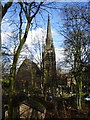
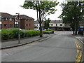
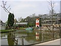
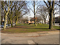
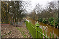
59 photos from this area
Area Information
Key information about the M30 9PL including its size, population, and administrative classification.
- Area Type
- Postcode
- Area Size
- 1.3 hectares
- Population
- 1453
- Population Density
- 4464 people/km²
House Prices in M30 9PL
36
Properties
£114,810
Average Sold Price
£22,300
Lowest Price
£231,000
Highest Price
Showing 36 properties
| Address | Type | Beds | Baths | Last Sale Price | Last Sale Date | |
|---|---|---|---|---|---|---|
| 35 Stanier Avenue, Eccles, M30 9PL | Terraced | 3 | 1 | £231,000 | Nov 2023 | |
| 23 Stanier Avenue, Eccles, M30 9PL | Flat | - | - | £50,000 | Sep 2022 | |
| 5 Stanier Avenue, Eccles, M30 9PL | Terraced | 3 | 2 | £185,000 | Jun 2021 | |
| 2 Stanier Avenue, Eccles, M30 9PL | Terraced | 3 | 2 | £180,000 | Apr 2019 | |
| 39 Stanier Avenue, Eccles, M30 9PL | Terraced | 3 | - | £125,000 | Feb 2016 | |
| 51 Stanier Avenue, Eccles, M30 9PL | house | - | - | £126,000 | Jul 2015 | |
| 17 Stanier Avenue, Eccles, M30 9PL | Flat | - | - | £22,300 | Sep 2014 | |
| 31 Stanier Avenue, Eccles, M30 9PL | house | 3 | - | £80,000 | Jun 2012 | |
| 16 Stanier Avenue, Eccles, M30 9PL | Terraced | 4 | - | £103,500 | Apr 2011 | |
| 1 Stanier Avenue, Eccles, M30 9PL | Terraced | - | - | £45,300 | Sep 1999 |
Page 1 of 4
Energy Efficiency in M30 9PL
Amenities
Schools
| Rank | School | Type | Entry gender | Ages |
|---|
Explore more schools in this area
Go to Schools tabDemographics
Household Size
Two person
most common
Accommodation Type
Houses
most common
Tenure
62
majority
Ethnic Group
White
most common
Religion
N/A
most common
Household Composition
N/A
most common
Age
47
median
Adults (30-64 years)
most common
Household Deprivation
N/A
with no deprivation
NS-SEC
42
in Lower managerial occupations
Explore more demographic insights in this area
Go to Demographics tabPlanning
Planning Constraints
- Flood RiskPremium
- Ramsar Wetland SitesPremium
- Area of Outstanding Natural BeautyPremium
- Protected Nature ReservePremium
- Protected WoodlandPremium