Area Overview for M30 8NZ
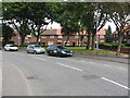
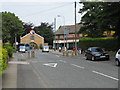
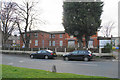
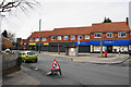
Photos of M30 8NZ


Area Information
Living in M30 8NZ offers a quiet, residential experience within a small cluster of homes. With a population of 1,668, the area is compact but well-served by nearby amenities. The community is predominantly composed of adults aged 30–64, reflecting a mature demographic. Most residents own their homes, with 69% of properties in private hands, and the housing stock is largely composed of houses rather than flats. This suggests a stable, family-oriented environment. The area is positioned near key transport hubs, including multiple railway stations and the City Airport Manchester, making it accessible for commuters. Local schools, such as St Patrick’s RC High School, provide education options for families. While the area lacks large-scale commercial centres, its proximity to retail outlets like Asda Eccles and Lidl Winton ensures daily needs are met. M30 8NZ is a practical choice for those seeking a settled lifestyle with a balance of local convenience and connectivity.
- Area Type
- Postcode
- Area Size
- Not available
- Population
- 1668
- Population Density
- 3866 people/km²
The property market in M30 8NZ is characterised by a high rate of home ownership—69% of properties are owner-occupied—indicating a stable, long-term resident base. The accommodation type is predominantly houses, which contrasts with areas dominated by flats or apartments. This suggests a market appealing to families or individuals seeking more space. As a small residential cluster, the area likely has limited housing stock, which could make it competitive for buyers. The presence of nearby amenities, including schools and transport links, may enhance its appeal. However, the lack of rental data means it is unclear whether the area functions more as an owner-occupied community or a rental market. For buyers, the focus on houses may align with those prioritising family-friendly living.
House Prices in M30 8NZ
No properties found in this postcode.
Energy Efficiency in M30 8NZ
Daily life in M30 8NZ benefits from a range of nearby amenities. Residents can access retail outlets like Lidl Winton, Asda Eccles, and Tesco Eccles for groceries and essentials. The area is served by multiple railway stations, including Patricroft and Eccles, as well as metro stops at Trafford Centre and Barton Dock Road, facilitating easy travel. The City Airport Manchester is within reach, adding to the area’s connectivity. For leisure, the Trafford Centre offers shopping and dining options, while Ladywell and Barton Dock Road provide additional local facilities. The combination of retail, transport, and nearby leisure spots creates a convenient lifestyle. While the area lacks large parks or cultural hubs, its practical amenities support a functional, community-focused way of life.
Amenities
Schools
Residents of M30 8NZ have access to two primary schools: St Gilbert’s RC Primary School and St Patrick’s RC High School. Both institutions serve the local community, though St Patrick’s holds a higher Ofsted rating of ‘good’ compared to St Gilbert’s ‘satisfactory’ rating. This mix of school types provides families with options, though no secondary schools are listed in the data. The presence of two primary schools within practical reach suggests a focus on early education, which may be beneficial for young families. However, the absence of secondary school data means parents may need to consider commuting for older children. The quality of local education is a key factor for families evaluating the area.
| Rank | School | Type | Entry gender | Ages |
|---|
Explore more schools in this area
Go to Schools tabDemographics
The population of M30 8NZ is 1,668, with a median age of 47. The most common age group is adults aged 30–64, indicating a mature, established community. Home ownership is high, at 69%, with the majority of properties being houses. The predominant ethnic group is White, though no specific data on diversity or deprivation is provided. This demographic profile suggests a relatively stable population with long-term residency. The age range implies a mix of working professionals and retirees, which may influence local services and amenities. With no data on deprivation levels, it is unclear how economic factors might affect quality of life, but the high home ownership rate and family-centric housing suggest a resilient community.
Household Size
Accommodation Type
Tenure
Ethnic Group
Religion
Household Composition
Age
Household Deprivation
NS-SEC
Explore more demographic insights in this area
Go to Demographics tabPlanning
Planning Constraints
- Flood RiskPremium
- Ramsar Wetland SitesPremium
- Area of Outstanding Natural BeautyPremium
- Protected Nature ReservePremium
- Protected WoodlandPremium