Area Overview for M30 5LL
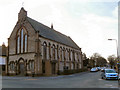
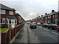
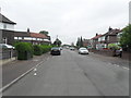
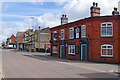
Photos of M30 5LL


Area Information
Living in M30 5LL means inhabiting a small, tightly knit residential cluster in England, home to 1,770 people spread across 201 people per square kilometre. This area is characterised by its compact nature, where daily life is shaped by proximity to essential services and a quiet, established community. The median age of 47 suggests a population skewed towards adults, with the 30–64 age range dominating. While the area lacks the density of a major city, it offers a balance of suburban convenience and manageable living. Residents benefit from nearby schools, retail hubs, and transport links, making it practical for families and commuters. The absence of major planning constraints or environmental restrictions means development is straightforward, though the small size of the area means choices for housing are limited. For those seeking a low-maintenance lifestyle with access to amenities, M30 5LL provides a snapshot of English suburbia, where familiarity and practicality take precedence.
- Area Type
- Postcode
- Area Size
- Not available
- Population
- 1770
- Population Density
- 201 people/km²
The property market in M30 5LL is defined by a 47% home ownership rate, with the majority of residents renting rather than owning. This suggests a rental market that may cater to families or professionals seeking stable, long-term housing. The accommodation type is predominantly houses, which contrasts with areas dominated by flats or apartments. This housing stock likely appeals to those prioritising space and privacy, though the small size of the area means competition for properties may be keen. For buyers, the limited number of homes available in M30 5LL itself means attention must turn to nearby areas for additional options. The focus on houses also implies a community oriented towards traditional family living, with potential for larger gardens or outdoor spaces.
House Prices in M30 5LL
No properties found in this postcode.
Energy Efficiency in M30 5LL
Daily life in M30 5LL is shaped by its proximity to practical amenities, including retail outlets like Lidl Irlam, Tesco Irlam, and Tesco Liverpool. These shops cater to everyday needs, from groceries to household goods. The area’s rail network, with stations such as Irlam and Glazebrook, connects residents to broader transport systems, while metro links to Trafford Centre and Timperley provide access to larger retail and leisure spaces. Though parks or green spaces are not explicitly mentioned, the absence of environmental constraints suggests room for local recreational activities. The mix of retail, transport, and nearby airports ensures a lifestyle that balances convenience with suburban tranquillity.
Amenities
Schools
Residents of M30 5LL have access to a range of schools, including St Teresa’s RC Primary School and Irlam and Cadishead College, both primary institutions. For secondary education, Irlam and Cadishead Academy is an academy with a good Ofsted rating, offering a structured learning environment. The presence of multiple primary schools, including a voluntary academy, provides families with choices in early education. The good rating at the academy indicates a standard of teaching and facilities that meets regulatory benchmarks. While no secondary schools are explicitly listed, the proximity of Irlam and Cadishead Academy suggests it serves the broader area. This mix of school types ensures options for both traditional and academically focused education, supporting families at different stages of their children’s schooling.
| Rank | School | Type | Entry gender | Ages |
|---|
Explore more schools in this area
Go to Schools tabDemographics
The community in M30 5LL is predominantly composed of adults aged 30–64, reflecting a median age of 47. This suggests a population largely in their prime working years, with a strong presence of families and established households. Home ownership stands at 47%, indicating that nearly half of residents rent, which may influence the local housing market’s dynamics. The accommodation type is primarily houses, which aligns with the area’s residential character and suggests a focus on family-friendly living spaces. The predominant ethnic group is White, though no specific data on diversity or deprivation is provided. The population density of 201 people per square kilometre implies a modest, closely spaced community, where social interactions and local services are likely to be central to daily life.
Household Size
Accommodation Type
Tenure
Ethnic Group
Religion
Household Composition
Age
Household Deprivation
NS-SEC
Explore more demographic insights in this area
Go to Demographics tabPlanning
Planning Constraints
- Flood RiskPremium
- Ramsar Wetland SitesPremium
- Area of Outstanding Natural BeautyPremium
- Protected Nature ReservePremium
- Protected WoodlandPremium