Area Overview for M3 1JD
Photos of M3 1JD

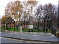


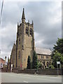

Area Information
Living in M3 1JD means inhabiting a tightly packed residential cluster in Manchester’s north-west, where 1,522 people reside across just 1,902 square metres. The area’s extreme population density—800,036 people per square kilometre—reflects its compact nature, with homes predominantly in flats rather than detached properties. This small postcode is a microcosm of a mature community, with a median age of 47 and most residents falling between 30 and 64 years old. Daily life here is shaped by proximity to transport hubs, retail, and schools, though the area’s limited size means it is best suited for those prioritising convenience over expansive living space. The surrounding infrastructure, including metro stations and railway links, ensures easy access to Manchester’s central districts, while the presence of a rated academy nearby adds appeal for families. However, the high population density and flat-dominated housing stock suggest a focus on practicality over spaciousness, making M3 1JD ideal for those seeking a compact, well-connected urban environment.
- Area Type
- Postcode
- Area Size
- 1902 m²
- Population
- 1522
- Population Density
- 2162 people/km²
The property market in M3 1JD is characterised by a low home ownership rate—just 24% of residents own their homes—suggesting a rental-heavy environment. The area’s housing stock is almost entirely composed of flats, which aligns with its high population density and compact footprint. This makes M3 1JD unsuitable for those seeking detached or semi-detached properties, but it may appeal to buyers prioritising affordability and proximity to transport. The small area size means property options are limited, and buyers may need to consider nearby postcode areas for more varied choices. The dominance of flats also implies a focus on short-term or investment properties, though the lack of data on average property prices or recent market trends means further research would be needed to assess investment potential.
House Prices in M3 1JD
No properties found in this postcode.
Energy Efficiency in M3 1JD
M3 1JD’s lifestyle is defined by its proximity to retail, transport, and public spaces. Residents have access to five retail outlets, including Co-op Cypress, M&S Cheetham Hill, and Lidl, providing everyday shopping convenience. The area’s transport network is robust, with metro stations like Victoria and Exchange Square, plus rail links to Manchester Oxford Road and Deansgate, enabling easy travel to employment hubs. While parks or leisure facilities are not explicitly listed in the data, the presence of multiple transport stops suggests a focus on connectivity over green spaces. The Chorlton Street Coach Station adds flexibility for those reliant on buses. Overall, the area offers a practical, urban lifestyle with immediate access to commerce and transport, though those prioritising nature or larger recreational areas may need to look further afield.
Amenities
Schools
The nearest school to M3 1JD is Eden Boys’ Leadership Academy in Manchester, an academy with a ‘good’ Ofsted rating. This institution serves the area’s educational needs, though its focus on boys may limit its appeal for families with daughters. The presence of a single rated academy suggests a limited range of school options, which could be a consideration for parents seeking diverse educational environments. The data does not mention primary schools or other educational institutions, so families may need to look beyond the immediate vicinity for broader choices. The school’s ‘good’ rating indicates acceptable standards, but the absence of additional schools highlights a potential gap in the area’s infrastructure for children of different ages or needs.
| Rank | School | Type | Entry gender | Ages |
|---|
Explore more schools in this area
Go to Schools tabDemographics
M3 1JD’s population skews heavily towards adults aged 30–64, with a median age of 47. Only 24% of residents own their homes, indicating a rental-dominated market, while flats are the primary accommodation type. The area’s predominant ethnic group is White, though specific data on diversity beyond this is not provided. The high population density—800,036 people per square kilometre—suggests a tightly packed community, which may influence local social dynamics and access to shared resources. With no data on deprivation levels, it is unclear how economic factors shape quality of life, but the age profile implies a stable, established population with potential demand for services tailored to middle-aged residents. The absence of detailed diversity metrics means broader cultural or social nuances remain unexplored in this analysis.
Household Size
Accommodation Type
Tenure
Ethnic Group
Religion
Household Composition
Age
Household Deprivation
NS-SEC
Explore more demographic insights in this area
Go to Demographics tabPlanning
Planning Constraints
- Flood RiskPremium
- Ramsar Wetland SitesPremium
- Area of Outstanding Natural BeautyPremium
- Protected Nature ReservePremium
- Protected WoodlandPremium