Area Overview for M29 8PX
Photos of M29 8PX

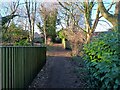
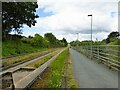
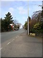
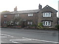

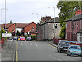
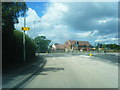
19 photos from this area
Area Information
Key information about the M29 8PX including its size, population, and administrative classification.
- Area Type
- Postcode
- Area Size
- 1.5 hectares
- Population
- 2731
- Population Density
- 2508 people/km²
House Prices in M29 8PX
39
Properties
£127,400
Average Sold Price
£60,000
Lowest Price
£192,601
Highest Price
Showing 39 properties
| Address | Type | Beds | Baths | Last Sale Price | Last Sale Date | |
|---|---|---|---|---|---|---|
| 16 Lynton Road, Tyldesley, M29 8PX | Semi-detached | 2 | 1 | £182,864 | Aug 2024 | |
| 38 Lynton Road, Tyldesley, M29 8PX | Retail | 3 | 1 | £175,000 | Feb 2023 | |
| 8 Lynton Road, Tyldesley, M29 8PX | Retail | 2 | 2 | £192,601 | Jul 2022 | |
| 74 Lynton Road, Tyldesley, M29 8PX | house | - | - | £192,000 | Nov 2021 | |
| 44 Lynton Road, Tyldesley, M29 8PX | Semi-detached | 3 | - | £153,000 | Oct 2019 | |
| 26 Lynton Road, Tyldesley, M29 8PX | Semi-detached | 2 | 1 | £85,000 | Mar 2017 | |
| 4 Lynton Road, Tyldesley, M29 8PX | house | - | - | £82,995 | Dec 2014 | |
| 56 Lynton Road, Tyldesley, M29 8PX | house | - | - | £102,995 | Aug 2014 | |
| 42 Lynton Road, Tyldesley, M29 8PX | house | - | - | £94,950 | Jan 2011 | |
| 36 Lynton Road, Tyldesley, M29 8PX | Semi-detached | - | - | £80,000 | Jan 2010 |
Page 1 of 4
Energy Efficiency in M29 8PX
Amenities
Schools
| Rank | School | Type | Entry gender | Ages |
|---|
Explore more schools in this area
Go to Schools tabDemographics
Household Size
Family (3-5 people)
most common
Accommodation Type
Houses
most common
Tenure
66
majority
Ethnic Group
White
most common
Religion
N/A
most common
Household Composition
N/A
most common
Age
47
median
Adults (30-64 years)
most common
Household Deprivation
N/A
with no deprivation
NS-SEC
40
in Lower managerial occupations
Explore more demographic insights in this area
Go to Demographics tabPlanning
Planning Constraints
- Flood RiskPremium
- Ramsar Wetland SitesPremium
- Area of Outstanding Natural BeautyPremium
- Protected Nature ReservePremium
- Protected WoodlandPremium