Area Overview for M29 7ET
Photos of M29 7ET


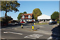
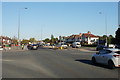

35 photos from this area
Area Information
Key information about the M29 7ET including its size, population, and administrative classification.
- Area Type
- Postcode
- Area Size
- 1.6 hectares
- Population
- 1445
- Population Density
- 4371 people/km²
House Prices in M29 7ET
29
Properties
£227,450
Average Sold Price
£78,000
Lowest Price
£450,000
Highest Price
Showing 29 properties
| Address | Type | Beds | Baths | Last Sale Price | Last Sale Date | |
|---|---|---|---|---|---|---|
| 215 Church Road, Astley, Tyldesley, M29 7ET | Semi-detached | 4 | 2 | £370,000 | Jun 2025 | |
| 225 Church Road, Astley, Tyldesley, M29 7ET | Semi-detached | 3 | 1 | £260,000 | Aug 2024 | |
| 239 Church Road, Astley, Tyldesley, M29 7ET | house | 3 | 1 | £229,000 | Dec 2023 | |
| 205 Church Road, Astley, Tyldesley, M29 7ET | Semi-detached | 3 | 1 | £295,000 | Jul 2023 | |
| 213 Church Road, Astley, Tyldesley, M29 7ET | Semi-detached | 3 | 1 | £297,000 | Jun 2023 | |
| 217 Church Road, Astley, Tyldesley, M29 7ET | Semi-detached | 3 | 2 | £290,000 | Apr 2022 | |
| 223 Church Road, Astley, Tyldesley, M29 7ET | house | - | - | £250,000 | Mar 2022 | |
| 211 Church Road, Astley, Tyldesley, M29 7ET | house | - | - | £245,000 | Jul 2020 | |
| 243 Church Road, Astley, Tyldesley, M29 7ET | Semi-detached | 3 | 1 | £167,000 | Sep 2019 | |
| 209 Church Road, Astley, Tyldesley, M29 7ET | Semi-detached | 3 | 1 | £224,000 | Jul 2016 |
Page 1 of 3
Energy Efficiency in M29 7ET
Amenities
Schools
| Rank | School | Type | Entry gender | Ages |
|---|
Explore more schools in this area
Go to Schools tabDemographics
Household Size
Two person
most common
Accommodation Type
Houses
most common
Tenure
92
majority
Ethnic Group
White
most common
Religion
N/A
most common
Household Composition
N/A
most common
Age
47
median
Adults (30-64 years)
most common
Household Deprivation
N/A
with no deprivation
NS-SEC
35
in Lower managerial occupations
Explore more demographic insights in this area
Go to Demographics tabPlanning
Planning Constraints
- Flood RiskPremium
- Ramsar Wetland SitesPremium
- Area of Outstanding Natural BeautyPremium
- Protected Nature ReservePremium
- Protected WoodlandPremium