Area Overview for M29 7BW
Photos of M29 7BW


Area Information
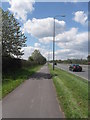
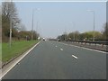
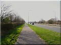
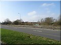
M29 7BW is a small, tightly knit residential area in England, home to 1,445 people. Its compact size means it’s a quiet, community-focused postcode, with a focus on stability and homeownership. The area is characterised by a mature population, with a median age of 47 and most residents falling within the 30-64 age range. This suggests a mix of established families and older professionals, creating a steady, low-turnover environment. The proximity to rail and metro networks, including Atherton and Walkden stations, ensures easy access to nearby towns and cities, while the nearby City Airport Manchester offers direct travel links. With 92% of homes owned by residents, M29 7BW is not a rental-heavy area, reflecting a long-term commitment to the locality. The broadband score of 98 — excellent by national standards — supports remote work and digital lifestyles, though mobile coverage is slightly lower at 85. For those seeking a balance between tranquillity and connectivity, this area offers a distinct blend of practicality and convenience.
- Area Type
- Postcode
- Area Size
- Not available
- Population
- 1445
- Population Density
- 4371 people/km²
M29 7BW is a predominantly owner-occupied area, with 92% of homes owned by residents rather than rented out. This high level of homeownership suggests a community with long-term ties to the area, where property is seen as a lasting investment. The accommodation type is exclusively houses, which is unusual for a small postcode but reflects the area’s low-density, suburban character. Given the small size of the postcode, the housing stock is limited, and the immediate surroundings may offer more options for buyers. The focus on owner-occupied homes means the market is likely to be competitive for those seeking to purchase, with limited turnover of properties. Buyers should consider the proximity to transport links and amenities, which may influence property values and desirability. The absence of rental properties also means the area is not a hotspot for short-term lettings or speculative investment.
House Prices in M29 7BW
No properties found in this postcode.
Energy Efficiency in M29 7BW
Living in M29 7BW offers access to a range of practical amenities within close reach. The area is served by five retail outlets, including Morrisons Daily, Co-op The, and Asda Astley, ensuring daily shopping needs are met. Rail and metro stations, such as Atherton and Trafford Centre, provide frequent connections to nearby towns and cities, while the proximity to City Airport Manchester adds convenience for travel. Although the area is small, its transport links and retail options create a lifestyle that balances local convenience with regional accessibility. The presence of multiple supermarkets and transport hubs suggests a practical, no-frills approach to daily living, ideal for those prioritising efficiency over sprawling commercial districts. For residents, this means a manageable routine of shopping, commuting, and travel without the need to venture far from home.
Amenities
Schools
| Rank | School | Type | Entry gender | Ages |
|---|
Explore more schools in this area
Go to Schools tabDemographics
The population of M29 7BW is predominantly adults aged 30-64, with a median age of 47. This suggests a mature, stable community with fewer young families or retirees compared to other areas. Home ownership is exceptionally high at 92%, indicating a strong preference for long-term residency over rental properties. The accommodation type is primarily houses, which aligns with the area’s low population density and residential character. The predominant ethnic group is White, though no specific diversity statistics are provided. This demographic profile implies a community with established roots, where most residents have lived for years or decades. The high home ownership rate and age distribution suggest a lower turnover of properties, which can be advantageous for buyers seeking a stable, low-competition market. However, the lack of data on deprivation or income levels means the full picture of quality of life remains partially obscured.
Household Size
Accommodation Type
Tenure
Ethnic Group
Religion
Household Composition
Age
Household Deprivation
NS-SEC
Explore more demographic insights in this area
Go to Demographics tabPlanning
Planning Constraints
- Flood RiskPremium
- Ramsar Wetland SitesPremium
- Area of Outstanding Natural BeautyPremium
- Protected Nature ReservePremium
- Protected WoodlandPremium