Area Overview for M28 4AB
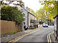
Photos of M28 4AB


Area Information
Living in M28 4AB means inhabiting a small, tightly knit residential cluster in England with a population of 1,633. This area is defined by its compact nature, where daily life revolves around local amenities and proximity to transport links. The community is predominantly composed of adults aged 30–64, with a median age of 47, suggesting a mature, stable demographic. Home ownership is high at 87%, indicating a strong sense of permanence among residents. While the area lacks large-scale infrastructure, its strategic location near rail, metro, and retail hubs ensures practical connectivity. The broadband score of 100 ensures seamless digital access, supporting remote work and online activities. However, the area’s small size means residents must balance convenience with limited local amenities, relying on nearby towns for broader services. This postcode is ideal for those prioritising security, connectivity, and a quiet, established community, though buyers should weigh the high crime risk against other advantages.
- Area Type
- Postcode
- Area Size
- Not available
- Population
- 1633
- Population Density
- 3526 people/km²
M28 4AB is a predominantly owner-occupied area, with 87% of residents living in homes they own. The accommodation type is exclusively houses, which is unusual for a small postcode area but suggests a focus on family homes or single-family dwellings. This composition indicates a market where property is seen as a long-term investment rather than a rental asset. The high home ownership rate may reduce the availability of rental properties, making it challenging for buyers seeking short-term or flexible housing solutions. Given the area’s small size, the immediate surroundings likely offer limited additional housing stock, meaning buyers should consider nearby towns for broader options. The presence of houses rather than flats or apartments also implies a preference for private, spacious living. For those prioritising stability and a sense of community, M28 4AB’s property market offers a distinct, mature environment, though its small scale may limit choice.
House Prices in M28 4AB
No properties found in this postcode.
Energy Efficiency in M28 4AB
Residents of M28 4AB have access to a range of local amenities within practical reach. Retail options include Co-op Ellenbrook, Sainsburys Boothstown, and Spar, offering everyday shopping needs. The area’s rail and metro networks, with stations like Walkden and Trafford Centre, provide easy access to larger towns and cities, while proximity to City Airport Manchester adds convenience for travel. Though the area itself is small, its transport links ensure residents can reach leisure, dining, and cultural hubs in nearby towns. The presence of multiple retail and transport points suggests a lifestyle that balances local convenience with regional connectivity. However, the lack of detailed information on parks or leisure facilities means the area’s recreational offerings remain unclear. Overall, M28 4AB supports a practical, commuter-friendly lifestyle with reliable access to essential services.
Amenities
Schools
| Rank | School | Type | Entry gender | Ages |
|---|
Explore more schools in this area
Go to Schools tabDemographics
The population of M28 4AB is 1,633, with a median age of 47 and the majority of residents falling within the 30–64 age range. This suggests a community of middle-aged adults, likely settled in long-term housing. Home ownership is exceptionally high at 87%, reflecting a strong preference for property ownership over renting. The accommodation type is predominantly houses, which aligns with the area’s low population density and residential character. The predominant ethnic group is White, though no specific data on diversity or deprivation is provided. The age profile indicates a mature demographic, which may influence local services and amenities. With 87% of residents owning their homes, the area is not a rental hotspot, potentially limiting availability for those seeking short-term housing. The absence of detailed diversity metrics means broader social dynamics remain unexplored, but the data confirms a stable, long-established community.
Household Size
Accommodation Type
Tenure
Ethnic Group
Religion
Household Composition
Age
Household Deprivation
NS-SEC
Explore more demographic insights in this area
Go to Demographics tabPlanning
Planning Constraints
- Flood RiskPremium
- Ramsar Wetland SitesPremium
- Area of Outstanding Natural BeautyPremium
- Protected Nature ReservePremium
- Protected WoodlandPremium