Area Overview for M28 3RJ
Photos of M28 3RJ
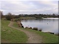
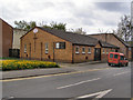
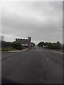
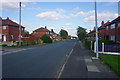
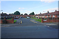
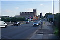
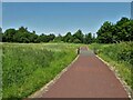


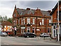
14 photos from this area
Area Information
Key information about the M28 3RJ including its size, population, and administrative classification.
- Area Type
- Postcode
- Area Size
- 5814 m²
- Population
- 2639
- Population Density
- 3667 people/km²
House Prices in M28 3RJ
29
Properties
£70,885
Average Sold Price
£23,000
Lowest Price
£145,000
Highest Price
Showing 29 properties
| Address | Type | Beds | Baths | Last Sale Price | Last Sale Date | |
|---|---|---|---|---|---|---|
| 24 Alexandra Road, Worsley, M28 3RJ | Terraced | 2 | 1 | £145,000 | Mar 2024 | |
| 26 Alexandra Road, Worsley, M28 3RJ | house | - | - | £78,000 | Dec 2020 | |
| 28 Alexandra Road, Worsley, M28 3RJ | Terraced | 2 | 1 | £85,000 | Jun 2019 | |
| 34 Alexandra Road, Worsley, M28 3RJ | Terraced | 2 | 1 | £110,000 | Jul 2018 | |
| 19 Alexandra Road, Worsley, M28 3RJ | Terraced | 3 | - | £80,000 | Sep 2017 | |
| 13 Alexandra Road, Worsley, M28 3RJ | Terraced | 3 | 1 | £90,000 | Aug 2017 | |
| 1 Alexandra Road, Worsley, M28 3RJ | house | 3 | 1 | £116,000 | Mar 2016 | |
| 42 Alexandra Road, Worsley, M28 3RJ | house | 2 | - | £55,000 | Dec 2010 | |
| 36 Alexandra Road, Worsley, M28 3RJ | house | - | - | £91,500 | Apr 2007 | |
| 2 Alexandra Road, Worsley, M28 3RJ | house | - | - | £55,000 | Jan 2006 |
Page 1 of 3
Energy Efficiency in M28 3RJ
Amenities
Schools
| Rank | School | Type | Entry gender | Ages |
|---|
Explore more schools in this area
Go to Schools tabDemographics
Household Size
Two person
most common
Accommodation Type
Houses
most common
Tenure
56
majority
Ethnic Group
White
most common
Religion
N/A
most common
Household Composition
N/A
most common
Age
47
median
Adults (30-64 years)
most common
Household Deprivation
N/A
with no deprivation
NS-SEC
30
in Lower managerial occupations
Explore more demographic insights in this area
Go to Demographics tabPlanning
Planning Constraints
- Flood RiskPremium
- Ramsar Wetland SitesPremium
- Area of Outstanding Natural BeautyPremium
- Protected Nature ReservePremium
- Protected WoodlandPremium