Area Overview for M28 3NH
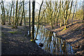
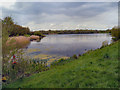
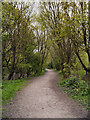
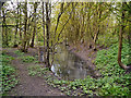
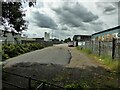
Photos of M28 3NH

Area Information
M28 3NH is a small, tightly packed residential cluster in England, home to 1965 people spread across a densely populated area with 1139 residents per square kilometre. This postcode area reflects a mature community, with a median age of 47 and a majority of residents aged between 30 and 64. The area is characterised by its compact nature, where homes are predominantly owner-occupied, and the local landscape is shaped by everyday living rather than natural features. Daily life here is defined by proximity to essential services, with rail and metro stations within reach, and a mix of retail options nearby. While the area lacks large-scale amenities, its small size fosters a sense of familiarity among residents. The high broadband score of 100 ensures seamless digital connectivity, though mobile coverage is slightly lower at 85. For those seeking a quiet, established neighbourhood with practical access to transport and retail, M28 3NH offers a straightforward, no-frills lifestyle.
- Area Type
- Postcode
- Area Size
- Not available
- Population
- 1965
- Population Density
- 1139 people/km²
M28 3NH is a predominantly owner-occupied area, with 73% of homes owned by residents rather than rented. The housing stock is largely composed of houses, not flats or apartments, which is typical for smaller, residential clusters. This suggests a market where property is seen as a long-term investment rather than a short-term rental opportunity. The area’s compact size means the housing stock is limited, which could lead to competition among buyers. Given the high home ownership rate, the local property market is likely to be stable, with prices reflecting the demand for owner-occupied homes in a well-connected, low-density setting. Buyers should consider the limited availability of properties and the potential for limited scope for development in such a small area.
House Prices in M28 3NH
No properties found in this postcode.
Energy Efficiency in M28 3NH
The lifestyle in M28 3NH is shaped by its proximity to essential amenities. Local retail options include Spar, Aldi Whittle, and M&S Walkden, providing access to everyday shopping needs. The area’s transport links are a significant advantage, with rail stations like Walkden and Kearsley offering connections to major routes, while metro stations such as Radcliffe and Whitefield provide links to surrounding areas. The nearby City Airport Manchester adds convenience for frequent flyers. Though the area lacks large parks or leisure facilities, its compact nature ensures that daily necessities are within easy reach. The mix of retail and transport options supports a practical, no-frills lifestyle, ideal for those prioritising accessibility over expansive amenities.
Amenities
Schools
| Rank | School | Type | Entry gender | Ages |
|---|
Explore more schools in this area
Go to Schools tabDemographics
The population of M28 3NH is predominantly adults aged 30 to 64, with a median age of 47. This suggests a community of middle-aged residents, likely settled in long-term housing. Home ownership is high at 73%, indicating a stable, owner-occupied demographic. The area is composed mainly of houses rather than flats or apartments, reflecting a traditional residential layout. The predominant ethnic group is White, though no specific diversity statistics are provided. The absence of detailed data on deprivation means the area’s quality of life is inferred from its infrastructure and services. With no significant environmental constraints or protected sites nearby, the community’s character is shaped by its density and proximity to transport links. The age profile suggests a population with established careers and family ties, contributing to a steady, low-turnover housing market.
Household Size
Accommodation Type
Tenure
Ethnic Group
Religion
Household Composition
Age
Household Deprivation
NS-SEC
Explore more demographic insights in this area
Go to Demographics tabPlanning
Planning Constraints
- Flood RiskPremium
- Ramsar Wetland SitesPremium
- Area of Outstanding Natural BeautyPremium
- Protected Nature ReservePremium
- Protected WoodlandPremium