Area Overview for M28 3LJ
Photos of M28 3LJ
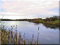
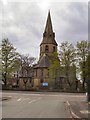
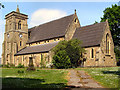
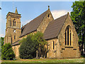

37 photos from this area
Area Information
Key information about the M28 3LJ including its size, population, and administrative classification.
- Area Type
- Postcode
- Area Size
- 1.7 hectares
- Population
- 1751
- Population Density
- 2805 people/km²
House Prices in M28 3LJ
39
Properties
£142,736
Average Sold Price
£37,000
Lowest Price
£270,000
Highest Price
Showing 39 properties
| Address | Type | Beds | Baths | Last Sale Price | Last Sale Date | |
|---|---|---|---|---|---|---|
| 29 Wilbraham Road, Worsley, M28 3LJ | Detached | 3 | 1 | £251,500 | Jun 2025 | |
| 7 Wilbraham Road, Worsley, M28 3LJ | Semi-detached | 4 | 1 | £270,000 | Mar 2025 | |
| 37 Wilbraham Road, Worsley, M28 3LJ | Semi-detached | 3 | 2 | £170,000 | Jan 2024 | |
| 51 Wilbraham Road, Worsley, M28 3LJ | Flat | 1 | 1 | £165,100 | Feb 2021 | |
| 33 Wilbraham Road, Worsley, M28 3LJ | Terraced | 3 | 1 | £163,000 | Nov 2020 | |
| 31 Wilbraham Road, Worsley, M28 3LJ | Terraced | 2 | 1 | £88,250 | Jun 2018 | |
| Mearc Denu Lodge, 3 Wilbraham Road, Worsley, M28 3LJ | Semi-detached | 3 | 1 | £140,000 | Feb 2018 | |
| 11 Wilbraham Road, Worsley, M28 3LJ | Semi-detached | 3 | 1 | £131,250 | Mar 2017 | |
| 19 Wilbraham Road, Worsley, M28 3LJ | Terraced | - | - | £85,000 | Aug 2008 | |
| 13 Wilbraham Road, Worsley, M28 3LJ | Semi-detached | - | - | £69,000 | Apr 2001 |
Page 1 of 4
Energy Efficiency in M28 3LJ
Amenities
Schools
| Rank | School | Type | Entry gender | Ages |
|---|
Explore more schools in this area
Go to Schools tabDemographics
Household Size
One person
most common
Accommodation Type
Houses
most common
Tenure
38
majority
Ethnic Group
White
most common
Religion
N/A
most common
Household Composition
N/A
most common
Age
47
median
Adults (30-64 years)
most common
Household Deprivation
N/A
with no deprivation
NS-SEC
19
in Lower managerial occupations
Explore more demographic insights in this area
Go to Demographics tabPlanning
Planning Constraints
- Flood RiskPremium
- Ramsar Wetland SitesPremium
- Area of Outstanding Natural BeautyPremium
- Protected Nature ReservePremium
- Protected WoodlandPremium