Area Overview for M28 3DT
Photos of M28 3DT
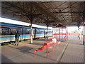


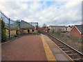
45 photos from this area
Area Information
Key information about the M28 3DT including its size, population, and administrative classification.
- Area Type
- Postcode
- Area Size
- 7450 m²
- Population
- 1838
- Population Density
- 6145 people/km²
House Prices in M28 3DT
34
Properties
£188,518
Average Sold Price
£59,000
Lowest Price
£290,000
Highest Price
Showing 34 properties
| Address | Type | Beds | Baths | Last Sale Price | Last Sale Date | |
|---|---|---|---|---|---|---|
| 33 Stanley Road, Worsley, M28 3DT | Semi-detached | 3 | 1 | £290,000 | Sep 2024 | |
| 25 Stanley Road, Worsley, M28 3DT | Terraced | 3 | 1 | £265,000 | Sep 2024 | |
| 39 Stanley Road, Worsley, M28 3DT | Semi-detached | 4 | 3 | £268,000 | Jul 2024 | |
| 17 Stanley Road, Worsley, M28 3DT | Terraced | 3 | 1 | £272,000 | Feb 2023 | |
| 13 Stanley Road, Worsley, M28 3DT | Terraced | 3 | 2 | £205,000 | Jan 2022 | |
| 21 Stanley Road, Worsley, M28 3DT | house | 3 | 1 | £162,500 | Feb 2021 | |
| 19 Stanley Road, Worsley, M28 3DT | Terraced | 3 | 1 | £205,500 | Jul 2020 | |
| 3 Stanley Road, Worsley, M28 3DT | Terraced | 3 | 1 | £206,000 | Jul 2020 | |
| 2 Stanley Road, Worsley, M28 3DT | Terraced | 6 | 6 | £130,000 | Mar 2019 | |
| 1 Stanley Road, Worsley, M28 3DT | house | - | - | £211,825 | Mar 2018 |
Page 1 of 4
Energy Efficiency in M28 3DT
Amenities
Schools
| Rank | School | Type | Entry gender | Ages |
|---|
Explore more schools in this area
Go to Schools tabDemographics
Household Size
One person
most common
Accommodation Type
Houses
most common
Tenure
48
majority
Ethnic Group
White
most common
Religion
N/A
most common
Household Composition
N/A
most common
Age
47
median
Adults (30-64 years)
most common
Household Deprivation
N/A
with no deprivation
NS-SEC
32
in Lower managerial occupations
Explore more demographic insights in this area
Go to Demographics tabPlanning
Planning Constraints
- Flood RiskPremium
- Ramsar Wetland SitesPremium
- Area of Outstanding Natural BeautyPremium
- Protected Nature ReservePremium
- Protected WoodlandPremium