Area Overview for M28 3BN
Photos of M28 3BN
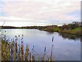
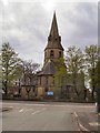
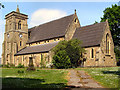
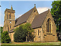
37 photos from this area
Area Information
Key information about the M28 3BN including its size, population, and administrative classification.
- Area Type
- Postcode
- Area Size
- 8810 m²
- Population
- 1751
- Population Density
- 2805 people/km²
House Prices in M28 3BN
34
Properties
£81,300
Average Sold Price
£40,000
Lowest Price
£140,000
Highest Price
Showing 34 properties
| Address | Type | Beds | Baths | Last Sale Price | Last Sale Date | |
|---|---|---|---|---|---|---|
| 196 Bolton Road, Worsley, M28 3BN | Terraced | 2 | 1 | £110,000 | Mar 2025 | |
| 222 Bolton Road, Worsley, M28 3BN | Terraced | 3 | 1 | £137,500 | Aug 2024 | |
| 224 Bolton Road, Worsley, M28 3BN | Terraced | 2 | 1 | £140,000 | Feb 2023 | |
| 226 Bolton Road, Worsley, M28 3BN | Terraced | 2 | 1 | £68,000 | Aug 2020 | |
| 194 Bolton Road, Worsley, M28 3BN | Terraced | 2 | 1 | £92,000 | Jan 2018 | |
| 206 Bolton Road, Worsley, M28 3BN | Terraced | 2 | 1 | £60,000 | Mar 2016 | |
| 208 Bolton Road, Worsley, M28 3BN | Terraced | 2 | 1 | £70,500 | Mar 2016 | |
| 220 Bolton Road, Worsley, M28 3BN | house | 2 | - | £50,000 | Oct 2014 | |
| 232 Bolton Road, Worsley, M28 3BN | house | - | - | £45,000 | Mar 2011 | |
| 190 Bolton Road, Worsley, M28 3BN | house | - | - | £40,000 | Aug 1996 |
Page 1 of 4
Energy Efficiency in M28 3BN
Amenities
Schools
| Rank | School | Type | Entry gender | Ages |
|---|
Explore more schools in this area
Go to Schools tabDemographics
Household Size
One person
most common
Accommodation Type
Houses
most common
Tenure
38
majority
Ethnic Group
White
most common
Religion
N/A
most common
Household Composition
N/A
most common
Age
47
median
Adults (30-64 years)
most common
Household Deprivation
N/A
with no deprivation
NS-SEC
19
in Lower managerial occupations
Explore more demographic insights in this area
Go to Demographics tabPlanning
Planning Constraints
- Flood RiskPremium
- Ramsar Wetland SitesPremium
- Area of Outstanding Natural BeautyPremium
- Protected Nature ReservePremium
- Protected WoodlandPremium