Area Overview for M28 2SW
Photos of M28 2SW

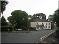

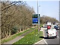
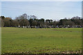
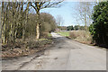

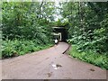
36 photos from this area
Area Information
Key information about the M28 2SW including its size, population, and administrative classification.
- Area Type
- Postcode
- Area Size
- 1.7 hectares
- Population
- 1679
- Population Density
- 2096 people/km²
House Prices in M28 2SW
26
Properties
£412,133
Average Sold Price
£86,500
Lowest Price
£800,000
Highest Price
Showing 26 properties
| Address | Type | Beds | Baths | Last Sale Price | Last Sale Date | |
|---|---|---|---|---|---|---|
| 67 Hazelhurst Road, Worsley, M28 2SW | Semi-detached | 4 | 3 | £385,000 | Sep 2024 | |
| 79 Hazelhurst Road, Worsley, M28 2SW | Semi-detached | 3 | 1 | £328,000 | May 2024 | |
| 81 Hazelhurst Road, Worsley, M28 2SW | house | - | - | £670,000 | Jun 2021 | |
| 73 Hazelhurst Road, Worsley, M28 2SW | Semi-detached | 3 | 1 | £245,000 | Feb 2021 | |
| 105 Hazelhurst Road, Worsley, M28 2SW | Semi-detached | 5 | 4 | £775,000 | Feb 2020 | |
| 97 Hazelhurst Road, Worsley, M28 2SW | Semi-detached | 4 | 2 | £515,000 | Dec 2019 | |
| 83 Hazelhurst Road, Worsley, M28 2SW | Semi-detached | 3 | 2 | £430,000 | Mar 2019 | |
| 91 Hazelhurst Road, Worsley, M28 2SW | Semi-detached | 4 | 2 | £385,000 | Dec 2017 | |
| 99 Hazelhurst Road, Worsley, M28 2SW | Detached | 4 | 2 | £640,000 | Sep 2017 | |
| 103 Hazelhurst Road, Worsley, M28 2SW | Detached | 5 | 3 | £800,000 | Jul 2016 |
Page 1 of 3
Energy Efficiency in M28 2SW
Amenities
Schools
| Rank | School | Type | Entry gender | Ages |
|---|
Explore more schools in this area
Go to Schools tabDemographics
Household Size
Family (3-5 people)
most common
Accommodation Type
Houses
most common
Tenure
85
majority
Ethnic Group
White
most common
Religion
N/A
most common
Household Composition
N/A
most common
Age
47
median
Adults (30-64 years)
most common
Household Deprivation
N/A
with no deprivation
NS-SEC
53
in Lower managerial occupations
Explore more demographic insights in this area
Go to Demographics tabPlanning
Planning Constraints
- Flood RiskPremium
- Ramsar Wetland SitesPremium
- Area of Outstanding Natural BeautyPremium
- Protected Nature ReservePremium
- Protected WoodlandPremium