Area Overview for M28 2SG
Photos of M28 2SG


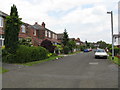
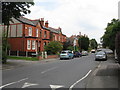
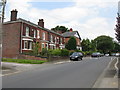
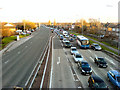
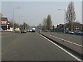

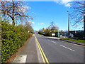
24 photos from this area
Area Information
Key information about the M28 2SG including its size, population, and administrative classification.
- Area Type
- Postcode
- Area Size
- 1.2 hectares
- Population
- 1679
- Population Density
- 2096 people/km²
House Prices in M28 2SG
29
Properties
£291,786
Average Sold Price
£50,000
Lowest Price
£605,000
Highest Price
Showing 29 properties
| Address | Type | Beds | Baths | Last Sale Price | Last Sale Date | |
|---|---|---|---|---|---|---|
| 60 Douglas Road, Worsley, M28 2SG | Semi-detached | 4 | 2 | £605,000 | Mar 2024 | |
| 46 Douglas Road, Worsley, M28 2SG | house | 3 | 1 | £360,000 | Feb 2024 | |
| 18 Douglas Road, Worsley, M28 2SG | Semi-detached | 3 | 1 | £320,000 | Jun 2023 | |
| 10 Douglas Road, Worsley, M28 2SG | Semi-detached | 5 | 3 | £510,000 | Apr 2023 | |
| 12 Douglas Road, Worsley, M28 2SG | Semi-detached | 3 | 2 | £550,000 | Feb 2023 | |
| 20 Douglas Road, Worsley, M28 2SG | house | - | - | £280,000 | Sep 2021 | |
| 42 Douglas Road, Worsley, M28 2SG | Semi-detached | 3 | 2 | £290,000 | Feb 2019 | |
| 4 Douglas Road, Worsley, M28 2SG | Semi-detached | 3 | 1 | £274,000 | Aug 2018 | |
| 38 Douglas Road, Worsley, M28 2SG | Semi-detached | 3 | 2 | £230,000 | Dec 2014 | |
| 50 Douglas Road, Worsley, M28 2SG | Detached | 3 | 1 | £262,000 | Mar 2014 |
Page 1 of 3
Energy Efficiency in M28 2SG
Amenities
Schools
| Rank | School | Type | Entry gender | Ages |
|---|
Explore more schools in this area
Go to Schools tabDemographics
Household Size
Family (3-5 people)
most common
Accommodation Type
Houses
most common
Tenure
85
majority
Ethnic Group
White
most common
Religion
N/A
most common
Household Composition
N/A
most common
Age
47
median
Adults (30-64 years)
most common
Household Deprivation
N/A
with no deprivation
NS-SEC
53
in Lower managerial occupations
Explore more demographic insights in this area
Go to Demographics tabPlanning
Planning Constraints
- Flood RiskPremium
- Ramsar Wetland SitesPremium
- Area of Outstanding Natural BeautyPremium
- Protected Nature ReservePremium
- Protected WoodlandPremium