Area Overview for M28 2PA
Photos of M28 2PA
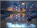
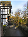
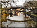
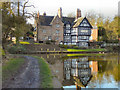
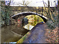
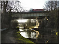
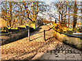
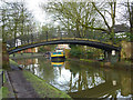
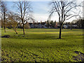
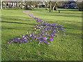
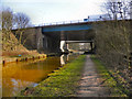
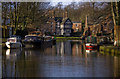
100 photos from this area
Area Information
Key information about the M28 2PA including its size, population, and administrative classification.
- Area Type
- Postcode
- Area Size
- 3.4 hectares
- Population
- 1933
- Population Density
- 597 people/km²
House Prices in M28 2PA
33
Properties
£364,869
Average Sold Price
£2,432
Lowest Price
£810,000
Highest Price
Showing 33 properties
| Address | Type | Beds | Baths | Last Sale Price | Last Sale Date | |
|---|---|---|---|---|---|---|
| 141 The Green, Worsley, M28 2PA | Terraced | 3 | 1 | £624,000 | Sep 2025 | |
| 140 The Green, Worsley, M28 2PA | Terraced | 4 | 1 | £810,000 | Aug 2025 | |
| 132 The Green, Worsley, M28 2PA | Cottage | 3 | 2 | £3,188 | Mar 2023 | |
| The Boathouse, The Green, Worsley, M28 2PA | Detached | - | - | £19,380 | Mar 2023 | |
| 133 The Green, Worsley, M28 2PA | Terraced | - | - | £2,432 | Mar 2023 | |
| 148 The Green, Worsley, M28 2PA | Terraced | 2 | 1 | £410,000 | Jan 2022 | |
| 153 The Green, Worsley, M28 2PA | house | 2 | - | £416,000 | Sep 2021 | |
| 139 The Green, Worsley, M28 2PA | Terraced | 2 | - | £380,000 | Mar 2021 | |
| 130 The Green, Worsley, M28 2PA | Semi-detached | 3 | 2 | £600,000 | Sep 2020 | |
| 135 The Green, Worsley, M28 2PA | Terraced | 2 | 1 | £385,000 | May 2020 |
Page 1 of 4
Energy Efficiency in M28 2PA
Amenities
Schools
| Rank | School | Type | Entry gender | Ages |
|---|
Explore more schools in this area
Go to Schools tabDemographics
Household Size
Two person
most common
Accommodation Type
Houses
most common
Tenure
84
majority
Ethnic Group
White
most common
Religion
N/A
most common
Household Composition
N/A
most common
Age
47
median
Adults (30-64 years)
most common
Household Deprivation
N/A
with no deprivation
NS-SEC
52
in Lower managerial occupations
Explore more demographic insights in this area
Go to Demographics tabPlanning
Planning Constraints
- Flood RiskPremium
- Ramsar Wetland SitesPremium
- Area of Outstanding Natural BeautyPremium
- Protected Nature ReservePremium
- Protected WoodlandPremium