Area Overview for M28 1YU
Photos of M28 1YU


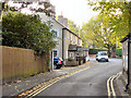


33 photos from this area
Area Information
Key information about the M28 1YU including its size, population, and administrative classification.
- Area Type
- Postcode
- Area Size
- 6.6 hectares
- Population
- 1633
- Population Density
- 3526 people/km²
House Prices in M28 1YU
43
Properties
£285,907
Average Sold Price
£73,500
Lowest Price
£525,000
Highest Price
Showing 43 properties
| Address | Type | Beds | Baths | Last Sale Price | Last Sale Date | |
|---|---|---|---|---|---|---|
| 27 Eastmoor, Worsley, M28 1YU | Detached | 3 | 2 | £399,500 | Jan 2024 | |
| 32 Eastmoor, Worsley, M28 1YU | Detached | 4 | 2 | £482,500 | Jun 2023 | |
| 12 Eastmoor, Worsley, M28 1YU | Detached | 4 | - | £450,000 | Jun 2021 | |
| 8 Eastmoor, Worsley, M28 1YU | house | - | - | £420,000 | Mar 2021 | |
| 19 Eastmoor, Worsley, M28 1YU | house | - | - | £525,000 | Dec 2020 | |
| 38 Eastmoor, Worsley, M28 1YU | Detached | 4 | 1 | £310,000 | Jul 2018 | |
| 6 Eastmoor, Worsley, M28 1YU | Detached | 4 | - | £347,500 | Apr 2016 | |
| 21 Eastmoor, Worsley, M28 1YU | Detached | 4 | 2 | £319,995 | Feb 2016 | |
| 23 Eastmoor, Worsley, M28 1YU | Detached | 4 | - | £264,000 | Jan 2016 | |
| 52 Eastmoor, Worsley, M28 1YU | Detached | 3 | - | £215,000 | Apr 2015 |
Page 1 of 5
Energy Efficiency in M28 1YU
Amenities
Schools
| Rank | School | Type | Entry gender | Ages |
|---|
Explore more schools in this area
Go to Schools tabDemographics
Household Size
Two person
most common
Accommodation Type
Houses
most common
Tenure
87
majority
Ethnic Group
White
most common
Religion
N/A
most common
Household Composition
N/A
most common
Age
47
median
Adults (30-64 years)
most common
Household Deprivation
N/A
with no deprivation
NS-SEC
48
in Lower managerial occupations
Explore more demographic insights in this area
Go to Demographics tabPlanning
Planning Constraints
- Flood RiskPremium
- Ramsar Wetland SitesPremium
- Area of Outstanding Natural BeautyPremium
- Protected Nature ReservePremium
- Protected WoodlandPremium