Area Overview for M28 1GP
Photos of M28 1GP
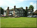
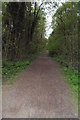
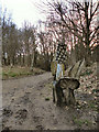
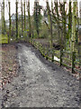


38 photos from this area
Area Information
Key information about the M28 1GP including its size, population, and administrative classification.
- Area Type
- Postcode
- Area Size
- 4.5 hectares
- Population
- 1511
- Population Density
- 172 people/km²
House Prices in M28 1GP
29
Properties
£526,560
Average Sold Price
£140,000
Lowest Price
£970,000
Highest Price
Showing 29 properties
| Address | Type | Beds | Baths | Last Sale Price | Last Sale Date | |
|---|---|---|---|---|---|---|
| 12 Crossfield Drive, Worsley, M28 1GP | Detached | 4 | 2 | £800,000 | Feb 2025 | |
| 13 Crossfield Drive, Worsley, M28 1GP | house | - | - | £970,000 | Apr 2024 | |
| 23 Crossfield Drive, Worsley, M28 1GP | Detached | 3 | 2 | £685,000 | Oct 2023 | |
| 2 Crossfield Drive, Worsley, M28 1GP | house | 3 | - | £800,000 | Oct 2023 | |
| 15 Crossfield Drive, Worsley, M28 1GP | house | 3 | 1 | £775,000 | Oct 2022 | |
| 10 Crossfield Drive, Worsley, M28 1GP | Semi-detached | 3 | 1 | £495,000 | May 2022 | |
| 9 Crossfield Drive, Worsley, M28 1GP | house | - | - | £595,000 | Jun 2021 | |
| 3 Crossfield Drive, Worsley, M28 1GP | Semi-detached | 4 | - | £662,500 | Feb 2021 | |
| 25 Crossfield Drive, Worsley, M28 1GP | house | - | - | £350,000 | Feb 2017 | |
| 28 Crossfield Drive, Worsley, M28 1GP | Detached | 4 | 2 | £450,000 | Nov 2015 |
Page 1 of 3
Energy Efficiency in M28 1GP
Amenities
Schools
| Rank | School | Type | Entry gender | Ages |
|---|
Explore more schools in this area
Go to Schools tabDemographics
Household Size
Two person
most common
Accommodation Type
Houses
most common
Tenure
93
majority
Ethnic Group
White
most common
Religion
N/A
most common
Household Composition
N/A
most common
Age
47
median
Adults (30-64 years)
most common
Household Deprivation
N/A
with no deprivation
NS-SEC
52
in Lower managerial occupations
Explore more demographic insights in this area
Go to Demographics tabPlanning
Planning Constraints
- Flood RiskPremium
- Ramsar Wetland SitesPremium
- Area of Outstanding Natural BeautyPremium
- Protected Nature ReservePremium
- Protected WoodlandPremium