Area Overview for M28 1AF
Photos of M28 1AF
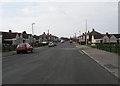
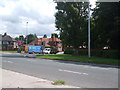
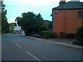
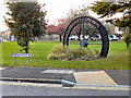
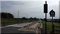
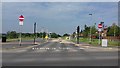
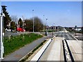
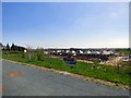
26 photos from this area
Area Information
Key information about the M28 1AF including its size, population, and administrative classification.
- Area Type
- Postcode
- Area Size
- 1.2 hectares
- Population
- 1581
- Population Density
- 816 people/km²
House Prices in M28 1AF
36
Properties
£147,938
Average Sold Price
£700
Lowest Price
£300,000
Highest Price
Showing 36 properties
| Address | Type | Beds | Baths | Last Sale Price | Last Sale Date | |
|---|---|---|---|---|---|---|
| 184 Mosley Common Road, Worsley, M28 1AF | Semi-detached | 4 | 2 | £300,000 | Nov 2022 | |
| 222A Mosley Common Road, Worsley, M28 1AF | Retail | 3 | 2 | £255,000 | Jun 2022 | |
| 226 Mosley Common Road, Worsley, M28 1AF | house | 2 | - | £135,000 | Feb 2021 | |
| 196 Mosley Common Road, Worsley, M28 1AF | Terraced | 2 | 1 | £144,500 | Sep 2020 | |
| 190 Mosley Common Road, Worsley, M28 1AF | Semi-detached | 2 | 1 | £160,000 | Apr 2020 | |
| 180 Mosley Common Road, Worsley, M28 1AF | house | - | - | £700 | Oct 2019 | |
| 150 Mosley Common Road, Worsley, M28 1AF | Terraced | 3 | - | £168,000 | Oct 2019 | |
| 202 Mosley Common Road, Worsley, M28 1AF | Terraced | 3 | 1 | £135,000 | Apr 2019 | |
| 156 Mosley Common Road, Worsley, M28 1AF | Terraced | 2 | 1 | £143,500 | Jun 2018 | |
| 220 Mosley Common Road, Worsley, M28 1AF | Terraced | 3 | - | £165,000 | Jan 2017 |
Page 1 of 4
Energy Efficiency in M28 1AF
Amenities
Schools
| Rank | School | Type | Entry gender | Ages |
|---|
Explore more schools in this area
Go to Schools tabDemographics
Household Size
Two person
most common
Accommodation Type
Houses
most common
Tenure
85
majority
Ethnic Group
White
most common
Religion
N/A
most common
Household Composition
N/A
most common
Age
47
median
Adults (30-64 years)
most common
Household Deprivation
N/A
with no deprivation
NS-SEC
33
in Lower managerial occupations
Explore more demographic insights in this area
Go to Demographics tabPlanning
Planning Constraints
- Flood RiskPremium
- Ramsar Wetland SitesPremium
- Area of Outstanding Natural BeautyPremium
- Protected Nature ReservePremium
- Protected WoodlandPremium