Area Overview for M27 9UQ
Photos of M27 9UQ
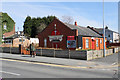
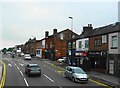
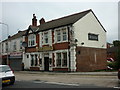
26 photos from this area
Area Information
Key information about the M27 9UQ including its size, population, and administrative classification.
- Area Type
- Postcode
- Area Size
- 1.1 hectares
- Population
- 1463
- Population Density
- 4617 people/km²
House Prices in M27 9UQ
26
Properties
£93,639
Average Sold Price
£17,500
Lowest Price
£165,000
Highest Price
Showing 26 properties
| Address | Type | Beds | Baths | Last Sale Price | Last Sale Date | |
|---|---|---|---|---|---|---|
| 409 Chorley Road, Swinton, M27 9UQ | Terraced | 2 | 2 | £160,000 | Jul 2025 | |
| 389 Chorley Road, Swinton, M27 9UQ | Terraced | 2 | 1 | £155,000 | Jun 2025 | |
| 385 Chorley Road, Swinton, M27 9UQ | Terraced | 2 | 1 | £163,000 | Apr 2025 | |
| 413 Chorley Road, Swinton, M27 9UQ | Retail | 3 | 1 | £133,000 | May 2022 | |
| 379 Chorley Road, Swinton, M27 9UQ | Terraced | 3 | 1 | £135,000 | Apr 2022 | |
| Premier Flooring Solutions, 417 Chorley Road, Swinton, M27 9UQ | Flat | - | - | £165,000 | Dec 2021 | |
| 399 Chorley Road, Swinton, M27 9UQ | Terraced | 3 | 2 | £146,000 | Jul 2019 | |
| 381 Chorley Road, Swinton, M27 9UQ | Retail | 2 | 1 | £80,000 | Jan 2017 | |
| 415 Chorley Road, Swinton, M27 9UQ | Terraced | 2 | 1 | £75,000 | Sep 2015 | |
| 401 Chorley Road, Swinton, M27 9UQ | house | 3 | 2 | £96,000 | Nov 2014 |
Page 1 of 3
Energy Efficiency in M27 9UQ
Amenities
Schools
| Rank | School | Type | Entry gender | Ages |
|---|
Explore more schools in this area
Go to Schools tabDemographics
Household Size
Family (3-5 people)
most common
Accommodation Type
Houses
most common
Tenure
61
majority
Ethnic Group
White
most common
Religion
N/A
most common
Household Composition
N/A
most common
Age
47
median
Adults (30-64 years)
most common
Household Deprivation
N/A
with no deprivation
NS-SEC
25
in Lower managerial occupations
Explore more demographic insights in this area
Go to Demographics tabPlanning
Planning Constraints
- Flood RiskPremium
- Ramsar Wetland SitesPremium
- Area of Outstanding Natural BeautyPremium
- Protected Nature ReservePremium
- Protected WoodlandPremium