Area Overview for M27 9PR
Photos of M27 9PR
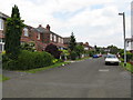
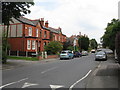
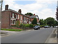
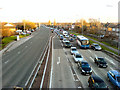

24 photos from this area
Area Information
Key information about the M27 9PR including its size, population, and administrative classification.
- Area Type
- Postcode
- Area Size
- 6086 m²
- Population
- 1366
- Population Density
- 4914 people/km²
House Prices in M27 9PR
23
Properties
£76,467
Average Sold Price
£21,950
Lowest Price
£160,000
Highest Price
Showing 23 properties
| Address | Type | Beds | Baths | Last Sale Price | Last Sale Date | |
|---|---|---|---|---|---|---|
| 99 Blantyre Street, Swinton, M27 9PR | Terraced | 4 | 4 | £152,250 | Jun 2023 | |
| 85 Blantyre Street, Swinton, M27 9PR | Semi-detached | 3 | 1 | £160,000 | Oct 2021 | |
| 103 Blantyre Street, Swinton, M27 9PR | Terraced | 2 | 1 | £92,000 | Jun 2019 | |
| 87 Blantyre Street, Swinton, M27 9PR | house | 3 | - | £100,000 | Jun 2016 | |
| 107 Blantyre Street, Swinton, M27 9PR | house | - | - | £40,000 | Jan 2012 | |
| 105 Blantyre Street, Swinton, M27 9PR | house | - | - | £38,000 | Sep 2011 | |
| 98 Blantyre Street, Swinton, M27 9PR | Terraced | 2 | 1 | £23,000 | Feb 2004 | |
| 91 Blantyre Street, Swinton, M27 9PR | Terraced | - | - | £61,000 | Nov 2003 | |
| 101 Blantyre Street, Swinton, M27 9PR | house | - | - | £21,950 | Mar 1996 | |
| 115 Shakespeare Road, Swinton, M27 9PR | Semi-detached | - | - | - | - |
Page 1 of 3
Energy Efficiency in M27 9PR
Amenities
Schools
| Rank | School | Type | Entry gender | Ages |
|---|
Explore more schools in this area
Go to Schools tabDemographics
Household Size
Family (3-5 people)
most common
Accommodation Type
Houses
most common
Tenure
35
majority
Ethnic Group
White
most common
Religion
N/A
most common
Household Composition
N/A
most common
Age
47
median
Adults (30-64 years)
most common
Household Deprivation
N/A
with no deprivation
NS-SEC
17
in Lower managerial occupations
Explore more demographic insights in this area
Go to Demographics tabPlanning
Planning Constraints
- Flood RiskPremium
- Ramsar Wetland SitesPremium
- Area of Outstanding Natural BeautyPremium
- Protected Nature ReservePremium
- Protected WoodlandPremium