Area Overview for M27 8AD
Photos of M27 8AD
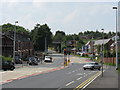
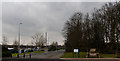
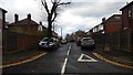
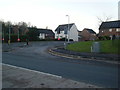

24 photos from this area
Area Information
Key information about the M27 8AD including its size, population, and administrative classification.
- Area Type
- Postcode
- Area Size
- 2.0 hectares
- Population
- 2044
- Population Density
- 1244 people/km²
House Prices in M27 8AD
34
Properties
£225,512
Average Sold Price
£139,500
Lowest Price
£352,500
Highest Price
Showing 34 properties
| Address | Type | Beds | Baths | Last Sale Price | Last Sale Date | |
|---|---|---|---|---|---|---|
| 9 Kilcoby Avenue, Swinton, M27 8AD | Terraced | 4 | 2 | £310,000 | Jul 2025 | |
| 51 Kilcoby Avenue, Swinton, M27 8AD | Semi-detached | 4 | 2 | £311,000 | Jul 2025 | |
| 25 Kilcoby Avenue, Swinton, M27 8AD | Semi-detached | 3 | 3 | £270,000 | Sep 2024 | |
| 69 Kilcoby Avenue, Swinton, M27 8AD | Semi-detached | 4 | 3 | £285,000 | Jan 2024 | |
| 53 Kilcoby Avenue, Swinton, M27 8AD | Terraced | 4 | 2 | £243,000 | Jan 2024 | |
| 59 Kilcoby Avenue, Swinton, M27 8AD | Terraced | 3 | 2 | £288,000 | Jun 2023 | |
| 61 Kilcoby Avenue, Swinton, M27 8AD | house | 4 | 3 | £270,000 | Sep 2022 | |
| 67 Kilcoby Avenue, Swinton, M27 8AD | Semi-detached | 4 | 2 | £285,000 | Sep 2022 | |
| 33 Kilcoby Avenue, Swinton, M27 8AD | house | - | - | £352,500 | Sep 2021 | |
| 49 Kilcoby Avenue, Swinton, M27 8AD | Semi-detached | 4 | 2 | £225,000 | Sep 2021 |
Page 1 of 4
Energy Efficiency in M27 8AD
Amenities
Schools
| Rank | School | Type | Entry gender | Ages |
|---|
Explore more schools in this area
Go to Schools tabDemographics
Household Size
Family (3-5 people)
most common
Accommodation Type
Houses
most common
Tenure
70
majority
Ethnic Group
White
most common
Religion
N/A
most common
Household Composition
N/A
most common
Age
47
median
Adults (30-64 years)
most common
Household Deprivation
N/A
with no deprivation
NS-SEC
22
in Lower managerial occupations
Explore more demographic insights in this area
Go to Demographics tabPlanning
Planning Constraints
- Flood RiskPremium
- Ramsar Wetland SitesPremium
- Area of Outstanding Natural BeautyPremium
- Protected Nature ReservePremium
- Protected WoodlandPremium