Area Overview for M27 4JE
Photos of M27 4JE
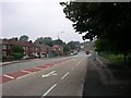
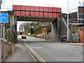
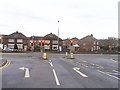
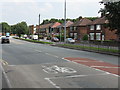
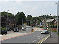
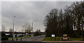
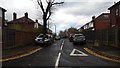
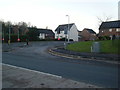
24 photos from this area
Area Information
Key information about the M27 4JE including its size, population, and administrative classification.
- Area Type
- Postcode
- Area Size
- 5201 m²
- Population
- 1790
- Population Density
- 7746 people/km²
House Prices in M27 4JE
17
Properties
£173,050
Average Sold Price
£44,995
Lowest Price
£323,000
Highest Price
Showing 17 properties
| Address | Type | Beds | Baths | Last Sale Price | Last Sale Date | |
|---|---|---|---|---|---|---|
| 13 Highfield Drive, Swinton, M27 4JE | Detached | 3 | 1 | £250,000 | Nov 2023 | |
| 25 Highfield Drive, Swinton, M27 4JE | Detached | 2 | 1 | £215,000 | Jun 2023 | |
| 14 Highfield Drive, Swinton, M27 4JE | Detached | 3 | 2 | £323,000 | Nov 2022 | |
| 5 Highfield Drive, Swinton, M27 4JE | Semi-detached | 3 | 1 | £210,000 | Jan 2018 | |
| 6 Highfield Drive, Swinton, M27 4JE | Semi-detached | 3 | 1 | £184,000 | Dec 2017 | |
| 21 Highfield Drive, Swinton, M27 4JE | Detached | 3 | 1 | £155,000 | Mar 2015 | |
| 10 Highfield Drive, Swinton, M27 4JE | house | - | - | £108,000 | Feb 2010 | |
| 23 Highfield Drive, Swinton, M27 4JE | house | - | - | £155,000 | Jul 2005 | |
| 17 Highfield Drive, Swinton, M27 4JE | Detached | - | - | £85,500 | May 2002 | |
| 19 Highfield Drive, Swinton, M27 4JE | house | - | - | £44,995 | Oct 1998 |
Page 1 of 2
Energy Efficiency in M27 4JE
Amenities
Schools
| Rank | School | Type | Entry gender | Ages |
|---|
Explore more schools in this area
Go to Schools tabDemographics
Household Size
Family (3-5 people)
most common
Accommodation Type
Houses
most common
Tenure
87
majority
Ethnic Group
White
most common
Religion
N/A
most common
Household Composition
N/A
most common
Age
47
median
Adults (30-64 years)
most common
Household Deprivation
N/A
with no deprivation
NS-SEC
35
in Lower managerial occupations
Explore more demographic insights in this area
Go to Demographics tabPlanning
Planning Constraints
- Flood RiskPremium
- Ramsar Wetland SitesPremium
- Area of Outstanding Natural BeautyPremium
- Protected Nature ReservePremium
- Protected WoodlandPremium