Area Overview for M27 4AG
Photos of M27 4AG
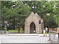

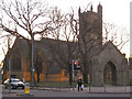

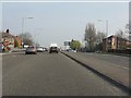
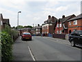
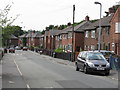

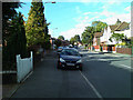
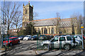
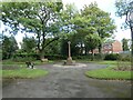
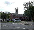
31 photos from this area
Area Information
Key information about the M27 4AG including its size, population, and administrative classification.
- Area Type
- Postcode
- Area Size
- 5639 m²
- Population
- 1278
- Population Density
- 5383 people/km²
House Prices in M27 4AG
40
Properties
£115,124
Average Sold Price
£17,600
Lowest Price
£285,000
Highest Price
Showing 40 properties
| Address | Type | Beds | Baths | Last Sale Price | Last Sale Date | |
|---|---|---|---|---|---|---|
| 31 Pendlebury Road, Swinton, M27 4AG | Terraced | 2 | 1 | £191,500 | Aug 2024 | |
| 73 Pendlebury Road, Swinton, M27 4AG | Terraced | 2 | 1 | £177,500 | Jul 2024 | |
| 17 Pendlebury Road, Swinton, M27 4AG | Terraced | 2 | 1 | £150,000 | Jul 2024 | |
| 71 Pendlebury Road, Swinton, M27 4AG | Terraced | 2 | 1 | £192,500 | Jun 2024 | |
| 47 Pendlebury Road, Swinton, M27 4AG | Terraced | 2 | 1 | £187,000 | Dec 2023 | |
| 77 Pendlebury Road, Swinton, M27 4AG | house | - | - | £285,000 | Nov 2023 | |
| 55 Pendlebury Road, Swinton, M27 4AG | Terraced | 2 | 1 | £180,000 | Mar 2023 | |
| 63 Pendlebury Road, Swinton, M27 4AG | house | - | - | £165,000 | Aug 2021 | |
| 57 Pendlebury Road, Swinton, M27 4AG | Terraced | 2 | 1 | £136,000 | Mar 2021 | |
| 49 Pendlebury Road, Swinton, M27 4AG | house | - | - | £175,000 | Mar 2021 |
Page 1 of 4
Energy Efficiency in M27 4AG
Amenities
Schools
| Rank | School | Type | Entry gender | Ages |
|---|
Explore more schools in this area
Go to Schools tabDemographics
Household Size
Two person
most common
Accommodation Type
Houses
most common
Tenure
59
majority
Ethnic Group
White
most common
Religion
N/A
most common
Household Composition
N/A
most common
Age
47
median
Adults (30-64 years)
most common
Household Deprivation
N/A
with no deprivation
NS-SEC
30
in Lower managerial occupations
Explore more demographic insights in this area
Go to Demographics tabPlanning
Planning Constraints
- Flood RiskPremium
- Ramsar Wetland SitesPremium
- Area of Outstanding Natural BeautyPremium
- Protected Nature ReservePremium
- Protected WoodlandPremium