Area Overview for M27 2SP
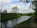
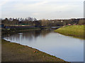
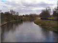
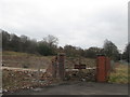
Photos of M27 2SP


Area Information
Living in M27 2SP means inhabiting a small, densely populated residential cluster in England, where 2,044 people reside across 1,643 square metres. This area’s compact size fosters a tight-knit community, with homes predominantly occupied by owners rather than renters. The median age of 47 suggests a mature demographic, with most residents falling between 30 and 64 years old. Daily life here balances suburban convenience with proximity to transport networks. The high population density means spaces are shared closely, but the area’s infrastructure, including rail and retail hubs, ensures practicality. While no natural reserves or flood risks are present, the area’s safety profile is a concern, with crime rates above average. For those prioritising connectivity, the broadband score of 93 and mobile coverage of 85 support modern lifestyles, though security measures are advised. M27 2SP is a place where practicality meets proximity, ideal for those seeking a compact, connected living environment.
- Area Type
- Postcode
- Area Size
- Not available
- Population
- 2044
- Population Density
- 1244 people/km²
The property market in M27 2SP is characterised by a high rate of home ownership—70 per cent of residents are homeowners—indicating a stable, long-term demographic. The accommodation type is predominantly houses, which suggests a focus on family-oriented or semi-detached living. This contrasts with areas dominated by flats or rental properties, where turnover is typically higher. The small size of the area means the housing stock is limited, and buyers should consider the immediate surroundings for additional options. The absence of planning constraints such as protected woodlands or AONB designations may offer flexibility for future developments, though the high crime risk could influence property desirability. For those seeking owner-occupied homes in a compact, connected setting, M27 2SP presents a niche opportunity, albeit with specific considerations.
House Prices in M27 2SP
No properties found in this postcode.
Energy Efficiency in M27 2SP
Residents of M27 2SP have access to a range of amenities within practical reach. Retail options include Aldi Irlam o’ the, Tesco Pendlebury, and Asda Pendlebury, offering everyday shopping convenience. The area’s rail and metro stations—Clifton, Swinton, Salford Crescent, Weaste, Prestwich, and Langworthy—provide easy access to urban centres and employment hubs. A nearby bus station and City Airport Manchester add to the connectivity, supporting both local and long-distance travel. While the data does not specify parks or leisure facilities, the presence of multiple transport links and retail outlets suggests a lifestyle focused on practicality and accessibility. The compact nature of the area means amenities are closely clustered, though residents may need to venture slightly further for specialised services.
Amenities
Schools
| Rank | School | Type | Entry gender | Ages |
|---|
Explore more schools in this area
Go to Schools tabDemographics
The community in M27 2SP is predominantly composed of adults aged 30–64, with a median age of 47. Seventy per cent of residents own their homes, a figure that underscores the area’s stability and long-term occupancy. The accommodation type is primarily houses, reflecting a preference for private, standalone properties. The dominant ethnic group is White, though the data does not specify further diversity metrics. With a population density of 1,244 people per square kilometre, the area is compact, which may influence social dynamics and shared resources. The lack of specific deprivation data means quality of life factors such as access to services or employment opportunities are not quantified here. However, the presence of multiple retail outlets and transport links suggests a functional, if limited, support network for residents.
Household Size
Accommodation Type
Tenure
Ethnic Group
Religion
Household Composition
Age
Household Deprivation
NS-SEC
Explore more demographic insights in this area
Go to Demographics tabPlanning
Planning Constraints
- Flood RiskPremium
- Ramsar Wetland SitesPremium
- Area of Outstanding Natural BeautyPremium
- Protected Nature ReservePremium
- Protected WoodlandPremium