Area Overview for M27 0PA
Photos of M27 0PA


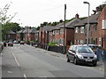

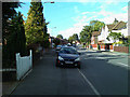
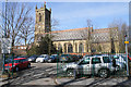
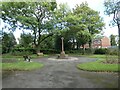
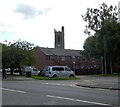
31 photos from this area
Area Information
Key information about the M27 0PA including its size, population, and administrative classification.
- Area Type
- Postcode
- Area Size
- 9314 m²
- Population
- 1366
- Population Density
- 4914 people/km²
House Prices in M27 0PA
33
Properties
£140,229
Average Sold Price
£69,795
Lowest Price
£280,000
Highest Price
Showing 33 properties
| Address | Type | Beds | Baths | Last Sale Price | Last Sale Date | |
|---|---|---|---|---|---|---|
| 14 Shelley Road, Swinton, M27 0PA | Semi-detached | 3 | 1 | £255,000 | Mar 2025 | |
| 24 Shelley Road, Swinton, M27 0PA | Semi-detached | 3 | 1 | £280,000 | Nov 2023 | |
| 40 Shelley Road, Swinton, M27 0PA | house | - | - | £140,000 | Feb 2019 | |
| 38 Shelley Road, Swinton, M27 0PA | Semi-detached | 3 | 1 | £146,000 | Feb 2018 | |
| 6 Shelley Road, Swinton, M27 0PA | house | 3 | 1 | £144,000 | Oct 2017 | |
| 48 Shelley Road, Swinton, M27 0PA | house | 3 | - | £115,000 | May 2011 | |
| 18 Shelley Road, Swinton, M27 0PA | house | - | - | £120,000 | Jan 2007 | |
| 20 Shelley Road, Swinton, M27 0PA | house | - | - | £110,000 | Feb 2006 | |
| 42 Shelley Road, Swinton, M27 0PA | house | - | - | £109,950 | Sep 2005 | |
| 34 Shelley Road, Swinton, M27 0PA | Semi-detached | 3 | 1 | £99,999 | Sep 2005 |
Page 1 of 4
Energy Efficiency in M27 0PA
Amenities
Schools
| Rank | School | Type | Entry gender | Ages |
|---|
Explore more schools in this area
Go to Schools tabDemographics
Household Size
Family (3-5 people)
most common
Accommodation Type
Houses
most common
Tenure
35
majority
Ethnic Group
White
most common
Religion
N/A
most common
Household Composition
N/A
most common
Age
47
median
Adults (30-64 years)
most common
Household Deprivation
N/A
with no deprivation
NS-SEC
17
in Lower managerial occupations
Explore more demographic insights in this area
Go to Demographics tabPlanning
Planning Constraints
- Flood RiskPremium
- Ramsar Wetland SitesPremium
- Area of Outstanding Natural BeautyPremium
- Protected Nature ReservePremium
- Protected WoodlandPremium