Area Overview for M26 9AS
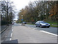
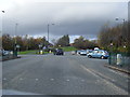
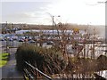
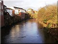
Photos of M26 9AS

Area Information
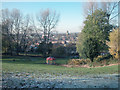
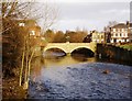
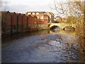
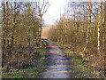
Living in M26 9AS means being part of a small, tightly knit residential cluster in the town of Radcliffe, Greater Manchester. With a population of 1,766, the area is defined by its historical roots along the River Irwell and its proximity to a Roman road that once connected Manchester to Ribchester. The community is anchored by landmarks such as the Grade I listed Radcliffe Tower, a 14th-century pele tower, and the Church of St Mary, which reflect the area’s medieval heritage. Daily life here balances historical charm with modern convenience, with nearby amenities including supermarkets like Lidl Radcliffe and Asda Greencroft. The area is served by multiple railway stations, including Kearsley and Clifton, linking residents to broader Greater Manchester networks. While the population is small, the mix of houses and proximity to transport make it a practical choice for those seeking a quiet yet connected lifestyle. The median age of 47 suggests a community of established residents, many of whom are in their prime working years, contributing to a stable local economy.
- Area Type
- Postcode
- Area Size
- Not available
- Population
- 1766
- Population Density
- 3526 people/km²
The property market in M26 9AS is characterised by a 35% home ownership rate, which is below the national average, indicating that the area leans more towards a rental market than owner-occupied housing. The accommodation type is predominantly houses, which are typically larger and more suited to families or individuals seeking space. Given the small population and limited area size, the housing stock is likely constrained, meaning buyers may find fewer options compared to larger urban centres. The presence of houses suggests a focus on traditional, perhaps older properties, which could appeal to those seeking character or historical value. However, the low home ownership rate implies competition for available properties, particularly for those prioritising long-term investment. For buyers, the area’s compact nature means proximity to amenities and transport is a key advantage, though the limited supply may require flexibility in property preferences.
House Prices in M26 9AS
No properties found in this postcode.
Energy Efficiency in M26 9AS
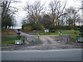
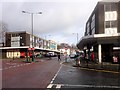
Residents of M26 9AS have access to a range of local amenities within practical reach. Retail options include Lidl Radcliffe, Asda Radcliffe, and Asda Greencroft, providing everyday shopping convenience. The area’s proximity to railway stations such as Kearsley and Clifton ensures easy access to broader regional networks, while metro stops at Radcliffe and Whitefield add to the connectivity. Although the data does not specify parks or leisure facilities, the historical presence of the River Irwell and nearby Roman roads suggest opportunities for walking or cycling. The mix of retail, transport, and historical sites contributes to a lifestyle that balances practicality with a touch of heritage. For those seeking a quiet yet connected existence, the area’s amenities offer a blend of modern convenience and traditional charm.
Amenities
Schools
| Rank | School | Type | Entry gender | Ages |
|---|
Explore more schools in this area
Go to Schools tabDemographics
The population of M26 9AS is predominantly adults aged 30–64, with a median age of 47. This indicates a community of middle-aged residents, many of whom may be in their peak earning years or nearing retirement. Home ownership in the area is relatively low at 35%, suggesting that a significant portion of the housing stock is rented out, possibly to younger professionals or families seeking affordability. The accommodation type is primarily houses, which contrasts with the higher proportion of flats or apartments seen in larger urban areas. The predominant ethnic group is White, reflecting the area’s historical and cultural continuity. While no specific data on deprivation is provided, the low home ownership rate could imply a reliance on rental income or a transient population. The age profile suggests a stable, mature community, but the limited data on diversity means the full demographic picture remains incomplete.
Household Size
Accommodation Type
Tenure
Ethnic Group
Religion
Household Composition
Age
Household Deprivation
NS-SEC
Explore more demographic insights in this area
Go to Demographics tabPlanning
Planning Constraints
- Flood RiskPremium
- Ramsar Wetland SitesPremium
- Area of Outstanding Natural BeautyPremium
- Protected Nature ReservePremium
- Protected WoodlandPremium