Area Overview for M26 9AR
Photos of M26 9AR

Area Information
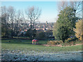
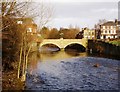
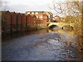
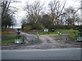
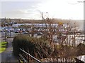
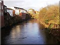
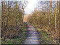
M26 9AR is a small residential cluster in England, nestled within the town of Radcliffe in Greater Manchester. With a population of just 1,766, it reflects a tight-knit community defined by its historical roots. The area’s character is shaped by its proximity to the River Irwell and the remnants of a Roman road that once connected Manchester to Ribchester. Radcliffe itself has long been a focal point, with landmarks like the Grade I listed Radcliffe Tower and Church of St Mary anchoring its identity. Daily life here is influenced by its compact size and proximity to local amenities, while its location within the Bury Metropolitan Borough offers access to broader regional networks. The area’s demographics suggest a mature population, with a median age of 47, and a focus on family-oriented living. For those considering homes in M26 9AR, the blend of historical significance and modern convenience makes it a distinct choice, though its small size means every decision about living here carries a sense of proximity and community.
- Area Type
- Postcode
- Area Size
- Not available
- Population
- 1766
- Population Density
- 3526 people/km²
The property market in M26 9AR is defined by a 35% home ownership rate, which is lower than the national average, suggesting a significant portion of the housing stock is rented out. The accommodation type is primarily houses, indicating a focus on single-family homes rather than flats or apartments. This mix of owner-occupied and rental properties may appeal to a range of buyers, from those seeking long-term investment in a stable area to renters looking for flexibility. The relatively small population and compact size of M26 9AR mean that the housing stock is limited, which could drive competition among buyers. For those considering purchasing, the predominance of houses may align with preferences for space and privacy, though the lower home ownership rate could also signal a market more open to new entrants. Buyers should also consider the area’s proximity to amenities and transport links when evaluating property value.
House Prices in M26 9AR
No properties found in this postcode.
Energy Efficiency in M26 9AR
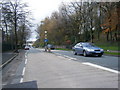
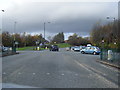
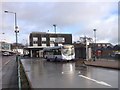
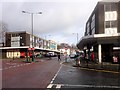
Living in M26 9AR offers access to a range of local amenities within practical reach. The area is served by five retail outlets, including Lidl Radcliffe, Asda Radcliffe, and Asda Greencroft, providing everyday shopping convenience. Nearby railway stations such as Kearsley and Clifton offer direct links to broader transport networks, while metro stops at Radcliffe and Whitefield enhance local connectivity. The historical character of the area is complemented by landmarks like the Radcliffe Tower and Church of St Mary, which add cultural and architectural interest. For residents, the proximity to shops, transport, and heritage sites creates a balanced lifestyle, blending modern practicality with historical significance. The compact nature of the area means amenities are close by, reducing the need for long commutes. This combination of convenience, history, and accessibility makes M26 9AR a practical choice for those seeking a mix of local engagement and regional reach.
Amenities
Schools
| Rank | School | Type | Entry gender | Ages |
|---|
Explore more schools in this area
Go to Schools tabDemographics
The population of M26 9AR is 1,766, with a median age of 47, indicating a predominantly adult population aged 30–64. This age range suggests a community centred on middle-aged residents, many of whom may be in their peak working years or nearing retirement. Home ownership in the area stands at 35%, which is notably lower than the national average, pointing to a mix of owner-occupied and rented properties. The accommodation type is primarily houses, reflecting a suburban or semi-rural character. The predominant ethnic group is White, with no data provided on other ethnicities. The low home ownership rate may indicate a reliance on rental housing, which could influence the local housing market dynamics. For residents, this demographic profile suggests a stable, mature community with established routines, though the lower ownership rate may also reflect economic factors or preferences for rental flexibility.
Household Size
Accommodation Type
Tenure
Ethnic Group
Religion
Household Composition
Age
Household Deprivation
NS-SEC
Explore more demographic insights in this area
Go to Demographics tabPlanning
Planning Constraints
- Flood RiskPremium
- Ramsar Wetland SitesPremium
- Area of Outstanding Natural BeautyPremium
- Protected Nature ReservePremium
- Protected WoodlandPremium