Area Overview for M26 4SD
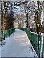
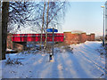
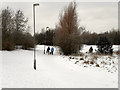
Photos of M26 4SD

Area Information
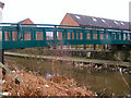
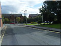
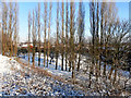
Living in M26 4SD means being part of a small, tightly knit residential cluster in the town of Radcliffe, Greater Manchester. With a population of just 1,550, this area blends historical charm with modern convenience. Radcliffe’s origins as a medieval parish, defined by its River Irwell and Roman road borders, still shape its character today. The area is home to landmarks like the Grade I listed Radcliffe Tower and Church of St Mary, offering glimpses into its past. Daily life here is grounded in local amenities, with nearby shops, rail links, and schools. The community is predominantly middle-aged, with 67% of residents owning their homes. While the area is compact, it connects to broader networks through transport routes like the East Lancashire Railway and modern metro systems. For buyers, M26 4SD offers a quiet, stable environment with a clear sense of place, though its small size means proximity to larger towns like Bury and Whitefield is key for additional services.
- Area Type
- Postcode
- Area Size
- Not available
- Population
- 1550
- Population Density
- 5576 people/km²
The property market in M26 4SD is characterised by a high rate of home ownership (67%) and a focus on houses rather than flats. This suggests a market skewed towards owner-occupied properties, likely attracting families or individuals seeking long-term stability. The prevalence of houses indicates a traditional housing stock, which may appeal to buyers looking for larger, more private living spaces. However, the small size of the area means the housing supply is limited, and buyers may need to consider nearby suburbs like Bury or Radcliffe for additional options. The compact nature of M26 4SD also means that properties are likely to be in close proximity to local amenities, reducing the need for long commutes. For investors, the high ownership rate may suggest a lower rental market, though the exact dynamics of the local property ecosystem remain unclear.
House Prices in M26 4SD
No properties found in this postcode.
Energy Efficiency in M26 4SD
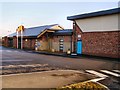
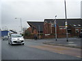
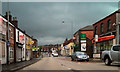
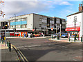
Life in M26 4SD is shaped by its proximity to a variety of amenities that cater to daily needs and leisure. Retail options include major chains like Tesco Radcliffe, Morrisons Daily, and Lidl Radcliffe, ensuring residents have access to groceries and household essentials without long trips. The area’s metro connections to Radcliffe, Whitefield, and Bury open up further opportunities for shopping, dining, and cultural activities. Rail stations such as Kearsley, Farnworth, and Moses Gate provide easy access to public transport, facilitating travel to work, schools, or social events. While the data does not specify parks or leisure facilities within M26 4SD itself, the surrounding town of Radcliffe offers historical landmarks like Radcliffe Tower and the Church of St Mary, which add to the area’s character. The blend of local convenience and regional connectivity makes daily life practical and varied, supporting both quiet living and active engagement with the wider community.
Amenities
Schools
Residents of M26 4SD have access to a range of primary schools, including Gorsefield Primary School, which holds an Ofsted rating of ‘good’. Other nearby schools include St Mary’s Roman Catholic Primary School, St Mary’s RC Junior School, and St Mary’s RC Infant School, all based in Radcliffe. The concentration of primary schools within a short distance of the area is a significant advantage for families, offering multiple educational options. The presence of both state and Catholic schools reflects the area’s diverse educational landscape, though no secondary schools are listed in the data. The proximity of these schools ensures that children can attend local institutions without lengthy commutes, supporting a family-friendly environment. The ‘good’ rating at Gorsefield Primary School adds a layer of reassurance for parents seeking quality education for their children.
| Rank | School | Type | Entry gender | Ages |
|---|
Explore more schools in this area
Go to Schools tabDemographics
The demographic profile of M26 4SD reflects a mature community, with a median age of 47 and the most common age range being adults aged 30–64. This suggests a population largely focused on settled, long-term living rather than transient or youthful demographics. Home ownership is high at 67%, indicating a stable, locally rooted population. The area is predominantly composed of houses, not flats, which aligns with the typical housing stock of small towns in the North West. The predominant ethnic group is White, with no specific data provided on other groups. The absence of detailed diversity statistics means the community’s composition is largely homogenous, though this does not necessarily reflect a lack of inclusivity. The age profile and ownership rates imply a low turnover of residents, fostering a familiar, neighbourly atmosphere.
Household Size
Accommodation Type
Tenure
Ethnic Group
Religion
Household Composition
Age
Household Deprivation
NS-SEC
Explore more demographic insights in this area
Go to Demographics tabPlanning
Planning Constraints
- Flood RiskPremium
- Ramsar Wetland SitesPremium
- Area of Outstanding Natural BeautyPremium
- Protected Nature ReservePremium
- Protected WoodlandPremium