Area Overview for M26 4HN
Photos of M26 4HN


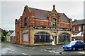
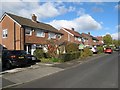
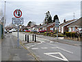
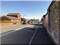
78 photos from this area
Area Information
Key information about the M26 4HN including its size, population, and administrative classification.
- Area Type
- Postcode
- Area Size
- 6172 m²
- Population
- 1477
- Population Density
- 754 people/km²
House Prices in M26 4HN
23
Properties
£84,419
Average Sold Price
£30,400
Lowest Price
£138,000
Highest Price
Showing 23 properties
| Address | Type | Beds | Baths | Last Sale Price | Last Sale Date | |
|---|---|---|---|---|---|---|
| 401 Ainsworth Road, Radcliffe, M26 4HN | Terraced | 2 | 1 | £105,000 | Sep 2024 | |
| 399 Ainsworth Road, Radcliffe, M26 4HN | Terraced | 2 | 1 | £135,000 | May 2024 | |
| 437 Ainsworth Road, Radcliffe, M26 4HN | Terraced | 4 | - | £116,950 | Dec 2016 | |
| 429 Ainsworth Road, Radcliffe, M26 4HN | Terraced | - | - | £60,000 | Dec 2014 | |
| 397 Ainsworth Road, Radcliffe, M26 4HN | house | 2 | - | £59,000 | Dec 2010 | |
| 435 Ainsworth Road, Radcliffe, M26 4HN | Terraced | 4 | 2 | £138,000 | Sep 2006 | |
| 433 Ainsworth Road, Radcliffe, M26 4HN | Terraced | - | - | £30,400 | May 1999 | |
| 393 Ainsworth Road, Radcliffe, M26 4HN | house | 3 | - | £31,000 | Sep 1996 | |
| 425 Ainsworth Road, Radcliffe, M26 4HN | Detached | - | - | - | - | |
| 389-391 Ainsworth Road, Radcliffe, M26 4HN | Office | - | - | - | - |
Page 1 of 3
Energy Efficiency in M26 4HN
Amenities
Schools
| Rank | School | Type | Entry gender | Ages |
|---|
Explore more schools in this area
Go to Schools tabDemographics
Household Size
Family (3-5 people)
most common
Accommodation Type
Houses
most common
Tenure
83
majority
Ethnic Group
White
most common
Religion
N/A
most common
Household Composition
N/A
most common
Age
47
median
Adults (30-64 years)
most common
Household Deprivation
N/A
with no deprivation
NS-SEC
30
in Lower managerial occupations
Explore more demographic insights in this area
Go to Demographics tabPlanning
Planning Constraints
- Flood RiskPremium
- Ramsar Wetland SitesPremium
- Area of Outstanding Natural BeautyPremium
- Protected Nature ReservePremium
- Protected WoodlandPremium