Area Overview for M26 4BA
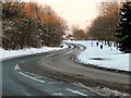
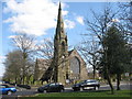
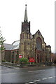
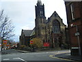
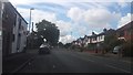
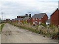
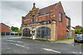
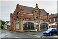
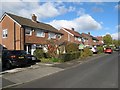
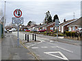
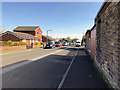
Photos of M26 4BA

Area Information
M26 4BA is a small residential postcode in England, nestled within the town of Radcliffe in Greater Manchester. With a population of just 1,485, it reflects a tight-knit community centred on historic and practical elements. The area’s roots trace back to medieval times, with landmarks like the Grade I listed Radcliffe Tower and Church of St Mary anchoring its identity. Radcliffe itself lies along the River Irwell, historically a Roman road border with Bury. Today, the postcode covers a cluster of homes near the coordinates 53.56935974431662, -2.302875064448946, blending modest living with proximity to nearby towns like Bury and Whitefield. Daily life here is shaped by its compact size and limited expansion, with residents relying on nearby amenities and transport links. The area’s low flood risk and absence of protected natural sites suggest a straightforward, practical environment, though its crime risk is notably high. For those seeking a quiet, historically grounded location with accessible services, M26 4BA offers a specific, if modest, slice of northern England’s suburban fabric.
- Area Type
- Postcode
- Area Size
- Not available
- Population
- 1485
- Population Density
- 9477 people/km²
The property market in M26 4BA is defined by its small size and focus on houses. With 51% of homes owner-occupied, the area leans more towards private residence than rental activity, though the limited population suggests a constrained market. The predominance of houses over flats or apartments indicates a traditional, low-density housing stock, likely appealing to families or individuals seeking space. However, the area’s compact nature means property availability is limited, and buyers may need to look beyond M26 4BA itself to find options. The lack of large-scale development or commercial zones implies a quiet, residential character, which could be a draw for those prioritising tranquillity over urban convenience. For buyers, this means a niche market with potential for stability but limited scalability.
House Prices in M26 4BA
No properties found in this postcode.
Energy Efficiency in M26 4BA
Living in M26 4BA offers access to a range of nearby amenities, though the area’s small size means most facilities are within walking or short driving distance. Retail options include Tesco Radcliffe, Morrisons Daily, and Spar Radcliffe, providing essential shopping. For transport, five rail stations—Kearsley, Farnworth, and Moses Gate—offer regular services to Manchester and beyond, while metro links to Radcliffe, Bury, and Whitefield enhance connectivity. The area’s proximity to the River Irwell and historical sites like Radcliffe Tower adds a local character, though recreational spaces are limited. Daily life here is practical, with a focus on nearby towns for more extensive leisure or dining options. The convenience of local shops and transport links balances the area’s compact nature, making it suitable for those prioritising accessibility over sprawling amenities.
Amenities
Schools
| Rank | School | Type | Entry gender | Ages |
|---|
Explore more schools in this area
Go to Schools tabDemographics
The population of M26 4BA is predominantly adults aged 30–64, with a median age of 47. This suggests a community of middle-aged residents, likely settled in long-term housing. Home ownership stands at 51%, indicating a mix of owner-occupied properties and rental homes. The accommodation type is primarily houses, which aligns with the area’s small-scale residential character. The predominant ethnic group is White, reflecting broader demographic trends in the region. While no specific deprivation data is provided, the age profile and home ownership rate imply a stable, established population. However, the high crime risk score of 0/100 raises practical concerns for residents, particularly regarding personal safety and property security. These factors may influence quality of life, necessitating careful consideration for prospective buyers or renters.
Household Size
Accommodation Type
Tenure
Ethnic Group
Religion
Household Composition
Age
Household Deprivation
NS-SEC
Explore more demographic insights in this area
Go to Demographics tabPlanning
Planning Constraints
- Flood RiskPremium
- Ramsar Wetland SitesPremium
- Area of Outstanding Natural BeautyPremium
- Protected Nature ReservePremium
- Protected WoodlandPremium