Area Overview for M26 3XD
Photos of M26 3XD

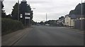
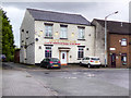
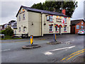
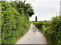

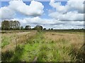

23 photos from this area
Area Information
Key information about the M26 3XD including its size, population, and administrative classification.
- Area Type
- Postcode
- Area Size
- 10.0 hectares
- Population
- 1955
- Population Density
- 4562 people/km²
House Prices in M26 3XD
25
Properties
£157,582
Average Sold Price
£70,000
Lowest Price
£365,000
Highest Price
Showing 25 properties
| Address | Type | Beds | Baths | Last Sale Price | Last Sale Date | |
|---|---|---|---|---|---|---|
| 4 Saltram Close, Radcliffe, M26 3XD | Retail | 4 | 2 | £365,000 | Dec 2021 | |
| 33 Saltram Close, Radcliffe, M26 3XD | Detached | 4 | 3 | £299,950 | Nov 2020 | |
| 29 Saltram Close, Radcliffe, M26 3XD | Detached | 3 | 3 | £265,000 | Aug 2017 | |
| 15 Saltram Close, Radcliffe, M26 3XD | house | - | - | £250,000 | Apr 2014 | |
| 18 Saltram Close, Radcliffe, M26 3XD | Detached | 5 | 4 | £210,000 | May 2013 | |
| 14 Saltram Close, Radcliffe, M26 3XD | Detached | - | - | £150,000 | Apr 2002 | |
| 2 Saltram Close, Radcliffe, M26 3XD | Detached | - | - | £135,000 | Apr 2002 | |
| 21 Saltram Close, Radcliffe, M26 3XD | Detached | - | - | £124,000 | Aug 2000 | |
| 10 Saltram Close, Radcliffe, M26 3XD | Detached | - | - | £90,000 | Oct 1998 | |
| 35 Saltram Close, Radcliffe, M26 3XD | Detached | - | - | £155,000 | Sep 1998 |
Page 1 of 3
Energy Efficiency in M26 3XD
Amenities
Schools
| Rank | School | Type | Entry gender | Ages |
|---|
Explore more schools in this area
Go to Schools tabDemographics
Household Size
Family (3-5 people)
most common
Accommodation Type
Houses
most common
Tenure
72
majority
Ethnic Group
White
most common
Religion
N/A
most common
Household Composition
N/A
most common
Age
47
median
Adults (30-64 years)
most common
Household Deprivation
N/A
with no deprivation
NS-SEC
27
in Lower managerial occupations
Explore more demographic insights in this area
Go to Demographics tabPlanning
Planning Constraints
- Flood RiskPremium
- Ramsar Wetland SitesPremium
- Area of Outstanding Natural BeautyPremium
- Protected Nature ReservePremium
- Protected WoodlandPremium