Area Overview for M26 2UT
Photos of M26 2UT
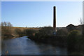
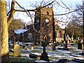
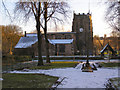
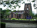
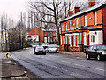
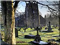
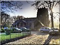
100 photos from this area
Area Information
Key information about the M26 2UT including its size, population, and administrative classification.
- Area Type
- Postcode
- Area Size
- 3.0 hectares
- Population
- 1382
- Population Density
- 1969 people/km²
House Prices in M26 2UT
55
Properties
£142,737
Average Sold Price
£30,000
Lowest Price
£500,000
Highest Price
Showing 55 properties
| Address | Type | Beds | Baths | Last Sale Price | Last Sale Date | |
|---|---|---|---|---|---|---|
| 101 Bury Road, Radcliffe, M26 2UT | Semi-detached | 3 | 1 | £235,000 | May 2025 | |
| 57 Bury Road, Radcliffe, M26 2UT | Semi-detached | 3 | 1 | £165,000 | Jan 2025 | |
| 107 Bury Road, Radcliffe, M26 2UT | Semi-detached | 3 | 2 | £255,000 | Feb 2024 | |
| 81 Bury Road, Radcliffe, M26 2UT | Semi-detached | 3 | 1 | £250,000 | Oct 2023 | |
| 89 Bury Road, Radcliffe, M26 2UT | Detached | 3 | - | £323,000 | Aug 2023 | |
| 59 Bury Road, Radcliffe, M26 2UT | house | 3 | - | £50,000 | Jan 2023 | |
| 125 Bury Road, Radcliffe, M26 2UT | Terraced | 2 | 1 | £149,500 | Jul 2021 | |
| 121 Bury Road, Radcliffe, M26 2UT | Terraced | 2 | 1 | £161,000 | Apr 2020 | |
| 139 Bury Road, Radcliffe, M26 2UT | Terraced | 3 | 1 | £82,500 | Mar 2020 | |
| 85 Bury Road, Radcliffe, M26 2UT | Semi-detached | 3 | 1 | £176,000 | Jun 2019 |
Page 1 of 6
Energy Efficiency in M26 2UT
Amenities
Schools
| Rank | School | Type | Entry gender | Ages |
|---|
Explore more schools in this area
Go to Schools tabDemographics
Household Size
Family (3-5 people)
most common
Accommodation Type
Houses
most common
Tenure
67
majority
Ethnic Group
White
most common
Religion
N/A
most common
Household Composition
N/A
most common
Age
47
median
Adults (30-64 years)
most common
Household Deprivation
N/A
with no deprivation
NS-SEC
26
in Lower managerial occupations
Explore more demographic insights in this area
Go to Demographics tabPlanning
Planning Constraints
- Flood RiskPremium
- Ramsar Wetland SitesPremium
- Area of Outstanding Natural BeautyPremium
- Protected Nature ReservePremium
- Protected WoodlandPremium