Area Overview for M26 2GB
Photos of M26 2GB
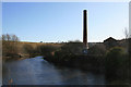
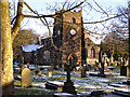
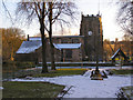
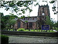
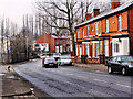
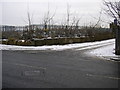
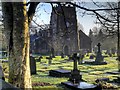
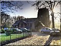
100 photos from this area
Area Information
Key information about the M26 2GB including its size, population, and administrative classification.
- Area Type
- Postcode
- Area Size
- 1.7 hectares
- Population
- 1425
- Population Density
- 1876 people/km²
House Prices in M26 2GB
19
Properties
£98,577
Average Sold Price
£23,500
Lowest Price
£375,000
Highest Price
Showing 19 properties
| Address | Type | Beds | Baths | Last Sale Price | Last Sale Date | |
|---|---|---|---|---|---|---|
| Indie 16 Ltd, 53 Bury Street, Radcliffe, M26 2GB | Detached | 9 | 4 | £375,000 | Jul 2024 | |
| 61 Bury Street, Radcliffe, M26 2GB | house | - | - | £125,000 | Feb 2021 | |
| 69 Bury Street, Radcliffe, M26 2GB | Terraced | 4 | 1 | £130,000 | Nov 2019 | |
| 71 Bury Street, Radcliffe, M26 2GB | house | 3 | - | £55,000 | Aug 2015 | |
| 67 Bury Street, Radcliffe, M26 2GB | Terraced | 3 | 1 | £39,000 | Apr 2013 | |
| 59 Bury Street, Radcliffe, M26 2GB | house | - | - | £60,000 | Dec 2009 | |
| 51 Bury Street, Radcliffe, M26 2GB | house | 1 | - | £155,000 | Jul 2008 | |
| 65 Bury Street, Radcliffe, M26 2GB | Terraced | 3 | - | £105,000 | Jan 2007 | |
| 49 Bury Street, Radcliffe, M26 2GB | Terraced | 3 | 1 | £40,000 | Feb 2005 | |
| 63 Bury Street, Radcliffe, M26 2GB | Terraced | - | - | £68,000 | Jun 2004 |
Page 1 of 2
Energy Efficiency in M26 2GB
Amenities
Schools
| Rank | School | Type | Entry gender | Ages |
|---|
Explore more schools in this area
Go to Schools tabDemographics
Household Size
One person
most common
Accommodation Type
Houses
most common
Tenure
62
majority
Ethnic Group
White
most common
Religion
N/A
most common
Household Composition
N/A
most common
Age
47
median
Adults (30-64 years)
most common
Household Deprivation
N/A
with no deprivation
NS-SEC
23
in Lower managerial occupations
Explore more demographic insights in this area
Go to Demographics tabPlanning
Planning Constraints
- Flood RiskPremium
- Ramsar Wetland SitesPremium
- Area of Outstanding Natural BeautyPremium
- Protected Nature ReservePremium
- Protected WoodlandPremium