Area Overview for M26 1JB
Photos of M26 1JB
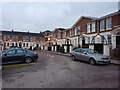
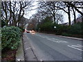
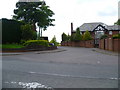
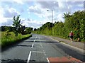
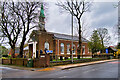
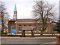
24 photos from this area
Area Information
Key information about the M26 1JB including its size, population, and administrative classification.
- Area Type
- Postcode
- Area Size
- 9.0 hectares
- Population
- 1756
- Population Density
- 2402 people/km²
House Prices in M26 1JB
39
Properties
£259,180
Average Sold Price
£59,500
Lowest Price
£650,000
Highest Price
Showing 39 properties
| Address | Type | Beds | Baths | Last Sale Price | Last Sale Date | |
|---|---|---|---|---|---|---|
| 344 Stand Lane, Radcliffe, M26 1JB | Semi-detached | 4 | 2 | £580,000 | Apr 2024 | |
| 5, North Woodley, Stand Lane, Radcliffe, M26 1JB | Terraced | 4 | 2 | £285,000 | Oct 2023 | |
| 316 Stand Lane, Radcliffe, M26 1JB | house | 2 | 1 | £352,050 | Feb 2023 | |
| 290 Stand Lane, Radcliffe, M26 1JB | house | 2 | 1 | £162,000 | Aug 2022 | |
| 336 Stand Lane, Radcliffe, M26 1JB | Semi-detached | 3 | 1 | £340,000 | Jun 2021 | |
| 298A Stand Lane, Radcliffe, M26 1JB | Detached | 4 | 3 | £650,000 | Jun 2021 | |
| 332 Stand Lane, Radcliffe, M26 1JB | house | - | - | £270,000 | May 2021 | |
| 312 Stand Lane, Radcliffe, M26 1JB | house | - | - | £270,000 | Nov 2020 | |
| 314 Stand Lane, Radcliffe, M26 1JB | Semi-detached | - | - | £250,000 | Mar 2020 | |
| 4, North Woodley, Stand Lane, Radcliffe, M26 1JB | Terraced | 2 | 1 | £177,000 | Nov 2019 |
Page 1 of 4
Energy Efficiency in M26 1JB
Amenities
Schools
| Rank | School | Type | Entry gender | Ages |
|---|
Explore more schools in this area
Go to Schools tabDemographics
Household Size
One person
most common
Accommodation Type
Houses
most common
Tenure
52
majority
Ethnic Group
White
most common
Religion
N/A
most common
Household Composition
N/A
most common
Age
47
median
Adults (30-64 years)
most common
Household Deprivation
N/A
with no deprivation
NS-SEC
29
in Lower managerial occupations
Explore more demographic insights in this area
Go to Demographics tabPlanning
Planning Constraints
- Flood RiskPremium
- Ramsar Wetland SitesPremium
- Area of Outstanding Natural BeautyPremium
- Protected Nature ReservePremium
- Protected WoodlandPremium