Area Overview for M26 0FB
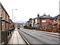
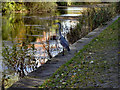
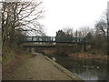
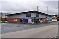
Photos of M26 0FB
Area Information
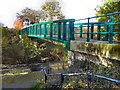
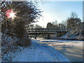
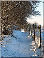
Living in M26 0FB means being part of a small, tightly knit residential cluster in England, nestled within the town of Radcliffe, Greater Manchester. With a population of 1,550, this area is characterised by its historical roots, centred on the River Irwell and a Roman road that once connected Manchester to Ribchester. The landscape is shaped by landmarks such as the Grade I listed Radcliffe Tower, a 14th-century ruin, and the Church of St Mary, which anchors the town’s heritage. Daily life here blends quiet residential living with proximity to practical amenities. The area’s compact size means residents are close to local services, schools, and transport links, while its position near Bury offers access to broader urban facilities. This is a place where history meets modern convenience, with a community defined by its age profile and stable housing stock. For those seeking a balance between tranquillity and connectivity, M26 0FB offers a distinct identity rooted in its past and present.
- Area Type
- Postcode
- Area Size
- Not available
- Population
- 1550
- Population Density
- 5576 people/km²
The property market in M26 0FB is dominated by owner-occupied homes, with 67% of residents living in houses rather than flats or rental properties. This suggests a stable, low-turnover market where long-term residency is common. The prevalence of houses over other accommodation types indicates a focus on family homes, likely with gardens and private outdoor space. Given the area’s small size and limited housing stock, buyers should consider the immediate surroundings for additional options. The high home ownership rate also implies that rental availability may be limited, making this a less attractive option for those seeking short-term tenancies. For buyers, the market offers a mix of established properties, but the compact nature of the area means competition for available homes could be fierce. Proximity to Bury and its broader infrastructure may provide alternative choices for those seeking more variety.
House Prices in M26 0FB
No properties found in this postcode.
Energy Efficiency in M26 0FB
The lifestyle in M26 0FB is shaped by its proximity to essential amenities. Within practical reach are retail outlets such as Tesco Radcliffe, Morrisons Daily, and Lidl Radcliffe, providing everyday shopping needs. The area’s metro and rail connections, including stations at Radcliffe, Whitefield, and Bury, offer access to broader urban facilities. While parks and leisure spaces are not explicitly listed in the data, the historical presence of the River Irwell and nearby Roman roads suggest opportunities for walking or cycling. The mix of retail and transport options ensures convenience for daily life, though the absence of specific leisure venues means residents may need to travel slightly further for recreational activities. This balance of practicality and historical context creates a lifestyle that prioritises accessibility without sacrificing the area’s character.
Amenities
Schools
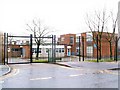
Residents of M26 0FB have access to several primary schools, including Gorsefield Primary School, St Mary’s Roman Catholic Primary School in Radcliffe, and St Mary’s RC Infant and Junior Schools. Gorsefield Primary School holds an Ofsted rating of ‘good’, reflecting its quality of education. The concentration of primary schools suggests a strong focus on early education, though secondary school options are not listed here. Families with young children will find multiple choices within walking distance, though the absence of secondary schools means students may need to commute to nearby towns. The mix of state and Catholic schools offers some diversity in educational approaches, but the lack of data on school capacity or performance beyond Ofsted ratings leaves gaps in understanding the full range of opportunities.
| Rank | School | Type | Entry gender | Ages |
|---|
Explore more schools in this area
Go to Schools tabDemographics
The community in M26 0FB is predominantly composed of adults aged 30–64, with a median age of 47. This suggests a population skewed toward middle-aged individuals, likely including families and professionals. Home ownership is high, with 67% of residents living in owner-occupied properties, and the primary accommodation type is houses rather than flats. The predominant ethnic group is White, reflecting the area’s historical and cultural makeup. The absence of specific data on deprivation or diversity metrics means the community’s socioeconomic profile remains largely unquantified, but the high home ownership rate implies a degree of financial stability. This demographic structure suggests a settled, family-oriented environment, with residents likely prioritising long-term residence over transient living. The age range also indicates a potential demand for schools and local services, which are well represented in the area.
Household Size
Accommodation Type
Tenure
Ethnic Group
Religion
Household Composition
Age
Household Deprivation
NS-SEC
Explore more demographic insights in this area
Go to Demographics tabPlanning
Planning Constraints
- Flood RiskPremium
- Ramsar Wetland SitesPremium
- Area of Outstanding Natural BeautyPremium
- Protected Nature ReservePremium
- Protected WoodlandPremium