Area Overview for M25 6QH
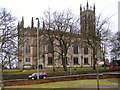
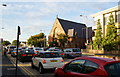
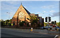
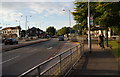
Photos of M25 6QH


Area Information
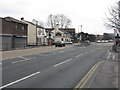
M25 6QH is a small, tightly knit residential cluster in England, home to 1627 residents. Its compact size means the area is characterised by a quiet, community-focused atmosphere, with homes predominantly in private ownership. The population skews towards adults aged 30–64, reflecting a mature demographic with established roots. Daily life here is shaped by proximity to local amenities, including five nearby metro stops and multiple rail stations, offering easy access to surrounding towns. The area’s schools, including Higher Lane Primary School and Philips High School, cater to families, while retail options like Morrisons and Aldi provide convenience. Despite its small footprint, M25 6QH balances practicality with a sense of stability, making it appealing to those seeking a settled, low-maintenance lifestyle. The broadband score of 96 ensures seamless digital connectivity, supporting remote work and online activities. However, the area’s small size means buyers should consider its limited housing stock and the importance of proximity to nearby services.
- Area Type
- Postcode
- Area Size
- Not available
- Population
- 1627
- Population Density
- 1773 people/km²
The property market in M25 6QH is defined by its 60% home ownership rate, with houses making up the majority of accommodation types. This indicates a market skewed towards owner-occupied properties rather than rental units, suggesting limited availability of flats or apartments. The small residential cluster means the housing stock is finite, which could make the area competitive for buyers. Given the high home ownership, properties here may hold value over time, especially for those seeking stability. However, the compact nature of the area means buyers should prioritise proximity to nearby amenities, such as schools and transport links, which are critical in such a small postcode. The predominance of houses also implies a focus on family-friendly living, with potential for larger properties compared to urban centres. For those considering the area, the limited housing supply means thorough research into local listings is essential.
House Prices in M25 6QH
No properties found in this postcode.
Energy Efficiency in M25 6QH
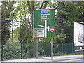
The lifestyle in M25 6QH is shaped by its proximity to a range of amenities. Residents can access five metro stops, including Whitefield and Prestwich, and five rail stations such as Clifton and Moorside, providing seamless travel options. Retail choices include Morrisons Whitefield, Aldi Whitefield, and Morrisons Daily, ensuring everyday shopping needs are met. The area’s small size means these amenities are within practical reach, enhancing convenience. While parks and leisure facilities are not explicitly listed, the presence of multiple transport hubs suggests access to nearby green spaces or recreational areas. The mix of retail, transport, and schools creates a self-contained environment where daily life is efficient and community-focused. For buyers, the combination of practical amenities and connectivity makes M25 6QH appealing to those prioritising accessibility over expansive leisure options.
Amenities
Schools
Residents of M25 6QH have access to several educational institutions, including Higher Lane Primary School, Higher Lane Junior School, and Philips High School. These schools cater to primary education, with Philips High School also operating as an academy. The presence of two primary schools suggests a focus on early education, while the academy model at Philips High School may indicate a specific curriculum or governance structure. Families in the area benefit from multiple options for primary schooling, though data on secondary education is limited to Philips High School. The mix of traditional and academy schools offers variety, but buyers should verify current Ofsted ratings and pupil outcomes to assess quality. The proximity of these schools to residential properties underscores the area’s appeal to families prioritising education.
| Rank | School | Type | Entry gender | Ages |
|---|
Explore more schools in this area
Go to Schools tabDemographics
The population of M25 6QH has a median age of 47, with the majority of residents falling within the 30–64 age range. This suggests a community of established professionals and families, rather than students or retirees. Home ownership is high at 60%, indicating a preference for long-term residency over renting. The area is predominantly White, with no specific data on other ethnic groups provided. The accommodation type is primarily houses, which aligns with the mature demographic and home ownership figures. This composition creates a stable, low-turnover community where residents are likely to have strong local ties. The absence of data on deprivation or diversity means the area’s social dynamics remain focused on its core demographic. For buyers, this profile suggests a market with predictable demand and a population that values security and continuity in their living environment.
Household Size
Accommodation Type
Tenure
Ethnic Group
Religion
Household Composition
Age
Household Deprivation
NS-SEC
Explore more demographic insights in this area
Go to Demographics tabPlanning
Planning Constraints
- Flood RiskPremium
- Ramsar Wetland SitesPremium
- Area of Outstanding Natural BeautyPremium
- Protected Nature ReservePremium
- Protected WoodlandPremium