Area Overview for M25 5QF
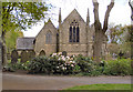
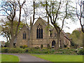
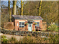
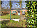
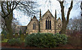
Photos of M25 5QF


Area Information
M25 5QF is a small, tightly knit residential postcode area in England, home to 1,544 residents. Its compact nature means it offers a quiet, community-focused environment, distinct from larger urban centres. The area’s character is shaped by its mature population, with a median age of 47 and a strong presence of adults aged 30–64. This suggests a stable, established community, likely centred around family homes and long-term residency. Daily life here is defined by proximity to local amenities, with shops, transport hubs, and schools within practical reach. The area’s small size means it is not a sprawling suburb but a cohesive cluster of homes, possibly with a village-like feel. While it lacks the anonymity of larger cities, it offers a sense of familiarity and accessibility. Residents benefit from excellent broadband connectivity and multiple transport options, including rail, metro, and bus services. However, the area’s character is not without challenges, particularly in terms of safety, which requires careful consideration for prospective buyers.
- Area Type
- Postcode
- Area Size
- Not available
- Population
- 1544
- Population Density
- 7321 people/km²
The property market in M25 5QF is characterised by high home ownership, with 79% of properties owned by their occupants. This suggests a stable, long-term residential market rather than a rental-focused area. The predominant accommodation type is houses, which is unusual for some urban postcode areas and may indicate a preference for traditional, family-sized homes. Given the small size of the postcode and the focus on owner-occupied properties, the housing stock is likely limited in both quantity and variety. Buyers should consider that the area may not offer a wide range of property types or price points. For those seeking a home in this area, the emphasis on houses and the existing ownership rates imply a market where properties are held for the long term, potentially leading to slower turnover and fewer new developments.
House Prices in M25 5QF
No properties found in this postcode.
Energy Efficiency in M25 5QF
Living in M25 5QF offers access to a range of local amenities within practical reach. The area includes five retail outlets, such as Tesco Prestwich, Asda Kirkhams, and Iceland Prestwich, providing everyday shopping needs. Metro stations like Prestwich, Heaton Park, and Besses o’th’ Barn serve as key transport links, while rail stations such as Clifton, Swinton, and Salford Crescent connect residents to broader regional networks. A bus stop at Chorlton Street Coach Station adds further accessibility. While the data does not specify parks or leisure facilities, the proximity to multiple transport and retail hubs suggests a lifestyle that balances convenience with the ability to travel further afield. The combination of local shops and transport options makes daily errands and commuting efficient, contributing to a practical, community-oriented way of life.
Amenities
Schools
| Rank | School | Type | Entry gender | Ages |
|---|
Explore more schools in this area
Go to Schools tabDemographics
The population of M25 5QF is predominantly composed of adults aged 30–64, reflecting a mature demographic with a median age of 47. This suggests a community of established residents, many of whom may be in their prime working years or nearing retirement. Home ownership is high, with 79% of properties owned by their occupants, indicating a stable housing market and a focus on long-term residency. The area is primarily composed of houses rather than flats, which aligns with the demographics of older, family-oriented households. The predominant ethnic group is White, which is consistent with broader regional trends in England. While no specific data on deprivation or diversity beyond ethnicity is provided, the high home ownership rate and age profile suggest a relatively affluent, settled population. This demographic profile may appeal to buyers seeking a quiet, family-friendly environment with minimal turnover.
Household Size
Accommodation Type
Tenure
Ethnic Group
Religion
Household Composition
Age
Household Deprivation
NS-SEC
Explore more demographic insights in this area
Go to Demographics tabPlanning
Planning Constraints
- Flood RiskPremium
- Ramsar Wetland SitesPremium
- Area of Outstanding Natural BeautyPremium
- Protected Nature ReservePremium
- Protected WoodlandPremium