Area Overview for M25 2WP
Photos of M25 2WP
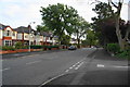
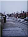
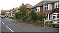

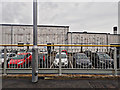
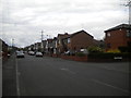
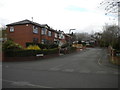
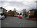
80 photos from this area
Area Information
Key information about the M25 2WP including its size, population, and administrative classification.
- Area Type
- Postcode
- Area Size
- 9788 m²
- Population
- 1494
- Population Density
- 152637 people/km²
House Prices in M25 2WP
38
Properties
£113,667
Average Sold Price
£29,000
Lowest Price
£237,000
Highest Price
Showing 38 properties
| Address | Type | Beds | Baths | Last Sale Price | Last Sale Date | |
|---|---|---|---|---|---|---|
| 8 Polefield Circle, Prestwich, M25 2WP | house | - | - | £215,000 | Jul 2024 | |
| 50 Polefield Circle, Prestwich, M25 2WP | Terraced | 3 | 1 | £180,000 | Feb 2024 | |
| 68 Polefield Circle, Prestwich, M25 2WP | Detached | 3 | 1 | £132,500 | Aug 2023 | |
| 30 Polefield Circle, Prestwich, M25 2WP | house | - | - | £90,000 | Feb 2023 | |
| 76 Polefield Circle, Prestwich, M25 2WP | Retail | 3 | 1 | £237,000 | Sep 2022 | |
| 64 Polefield Circle, Prestwich, M25 2WP | house | - | - | £158,500 | Sep 2021 | |
| 62 Polefield Circle, Prestwich, M25 2WP | house | - | - | £131,000 | Jul 2020 | |
| 54 Polefield Circle, Prestwich, M25 2WP | Terraced | 3 | 1 | £130,000 | Jun 2019 | |
| 28 Polefield Circle, Prestwich, M25 2WP | house | - | - | £85,000 | Jun 2015 | |
| 42 Polefield Circle, Prestwich, M25 2WP | Terraced | 3 | - | £85,000 | Aug 2011 |
Page 1 of 4
Energy Efficiency in M25 2WP
Amenities
Schools
| Rank | School | Type | Entry gender | Ages |
|---|
Explore more schools in this area
Go to Schools tabDemographics
Household Size
Family (3-5 people)
most common
Accommodation Type
Houses
most common
Tenure
51
majority
Ethnic Group
White
most common
Religion
N/A
most common
Household Composition
N/A
most common
Age
47
median
Adults (30-64 years)
most common
Household Deprivation
N/A
with no deprivation
NS-SEC
23
in Lower managerial occupations
Explore more demographic insights in this area
Go to Demographics tabPlanning
Planning Constraints
- Flood RiskPremium
- Ramsar Wetland SitesPremium
- Area of Outstanding Natural BeautyPremium
- Protected Nature ReservePremium
- Protected WoodlandPremium