Area Overview for M25 2QA
Photos of M25 2QA
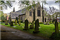
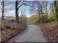
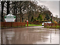
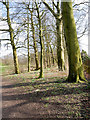
62 photos from this area
Area Information
Key information about the M25 2QA including its size, population, and administrative classification.
- Area Type
- Postcode
- Area Size
- 1834 m²
- Population
- 1544
- Population Density
- 7321 people/km²
House Prices in M25 2QA
8
Properties
£168,517
Average Sold Price
£43,950
Lowest Price
£430,000
Highest Price
Showing 8 properties
| Address | Type | Beds | Baths | Last Sale Price | Last Sale Date | |
|---|---|---|---|---|---|---|
| 27 Polefield Road, Prestwich, M25 2QA | Terraced | 4 | 2 | £430,000 | May 2024 | |
| 29 Polefield Road, Prestwich, M25 2QA | house | 3 | - | £172,500 | Jul 2011 | |
| 21 Polefield Road, Prestwich, M25 2QA | Terraced | - | - | £127,000 | May 2008 | |
| 17 Polefield Road, Prestwich, M25 2QA | Terraced | - | - | £192,650 | Jul 2006 | |
| 15A Polefield Road, Prestwich, M25 2QA | Detached | - | - | £45,000 | Oct 2001 | |
| 25 Polefield Road, Prestwich, M25 2QA | house | - | - | £43,950 | May 1999 | |
| 23 Polefield Road, Prestwich, M25 2QA | house | - | - | - | - | |
| 19 Polefield Road, Prestwich, M25 2QA | Terraced | - | - | - | - |
Energy Efficiency in M25 2QA
Amenities
Schools
| Rank | School | Type | Entry gender | Ages |
|---|
Explore more schools in this area
Go to Schools tabDemographics
Household Size
Family (3-5 people)
most common
Accommodation Type
Houses
most common
Tenure
79
majority
Ethnic Group
White
most common
Religion
N/A
most common
Household Composition
N/A
most common
Age
47
median
Adults (30-64 years)
most common
Household Deprivation
N/A
with no deprivation
NS-SEC
45
in Lower managerial occupations
Explore more demographic insights in this area
Go to Demographics tabPlanning
Planning Constraints
- Flood RiskPremium
- Ramsar Wetland SitesPremium
- Area of Outstanding Natural BeautyPremium
- Protected Nature ReservePremium
- Protected WoodlandPremium