Area Overview for M25 0AD
Photos of M25 0AD
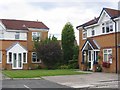
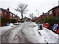
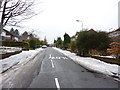
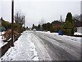
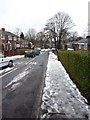
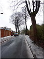
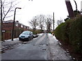
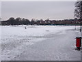

80 photos from this area
Area Information
Key information about the M25 0AD including its size, population, and administrative classification.
- Area Type
- Postcode
- Area Size
- 8647 m²
- Population
- 1952
- Population Density
- 5878 people/km²
House Prices in M25 0AD
16
Properties
£362,440
Average Sold Price
£93,500
Lowest Price
£565,000
Highest Price
Showing 16 properties
| Address | Type | Beds | Baths | Last Sale Price | Last Sale Date | |
|---|---|---|---|---|---|---|
| 8 Woodhill Drive, Prestwich, M25 0AD | house | - | - | £565,000 | Apr 2022 | |
| 28 Woodhill Drive, Prestwich, M25 0AD | Detached | 4 | 1 | £475,000 | Jun 2021 | |
| 22 Woodhill Drive, Prestwich, M25 0AD | Semi-detached | 5 | 4 | £425,000 | Dec 2020 | |
| 24 Woodhill Drive, Prestwich, M25 0AD | house | - | - | £375,000 | Nov 2020 | |
| 30 Woodhill Drive, Prestwich, M25 0AD | Detached | 5 | 1 | £490,000 | Feb 2020 | |
| 6 Woodhill Drive, Prestwich, M25 0AD | house | - | - | £400,000 | Mar 2019 | |
| 2 Woodhill Drive, Prestwich, M25 0AD | Detached | 4 | 3 | £399,950 | Oct 2006 | |
| 14 Woodhill Drive, Prestwich, M25 0AD | house | - | - | £236,000 | Jan 2006 | |
| 20 Woodhill Drive, Prestwich, M25 0AD | Semi-detached | 4 | 2 | £164,950 | Nov 2002 | |
| 18 Woodhill Drive, Prestwich, M25 0AD | Detached | 4 | 2 | £93,500 | Jul 1998 |
Page 1 of 2
Energy Efficiency in M25 0AD
Amenities
Schools
| Rank | School | Type | Entry gender | Ages |
|---|
Explore more schools in this area
Go to Schools tabDemographics
Household Size
Family (3-5 people)
most common
Accommodation Type
Houses
most common
Tenure
75
majority
Ethnic Group
White
most common
Religion
N/A
most common
Household Composition
N/A
most common
Age
47
median
Adults (30-64 years)
most common
Household Deprivation
N/A
with no deprivation
NS-SEC
41
in Lower managerial occupations
Explore more demographic insights in this area
Go to Demographics tabPlanning
Planning Constraints
- Flood RiskPremium
- Ramsar Wetland SitesPremium
- Area of Outstanding Natural BeautyPremium
- Protected Nature ReservePremium
- Protected WoodlandPremium