Area Overview for M24 2YX
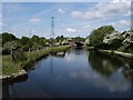
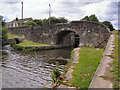
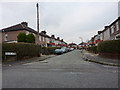
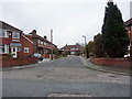
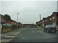
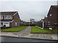
Photos of M24 2YX


Area Information
Living in M24 2YX means inhabiting a small, tightly knit residential cluster in England, covering just 10.8 hectares. With a population of 1,251 people, the area has a density of 402 people per square kilometre, reflecting a compact, community-focused layout. This postcode is characterised by its modest size and the prevalence of owner-occupied homes, with 80% of properties in private hands. The area’s residents are predominantly adults aged 30–64, creating a mature demographic profile. Daily life here balances proximity to essential services with the quietude of a low-density environment. While M24 2YX lacks expansive green spaces or major landmarks, its appeal lies in its practicality: nearby rail and metro stations, a handful of retail outlets, and a straightforward, no-frills lifestyle. The area is not suited for those seeking sprawling estates or high-end amenities, but it offers a functional base for those prioritising accessibility over grandeur. Its small footprint means every resident is likely within walking distance of key services, though the limited housing stock suggests a stable, long-term community rather than a transient one.
- Area Type
- Postcode
- Area Size
- 10.8 hectares
- Population
- 1251
- Population Density
- 402 people/km²
The property market in M24 2YX is defined by its high home ownership rate of 80% and the predominance of houses as the primary accommodation type. This suggests a market skewed towards owner-occupied properties rather than rentals, with limited scope for investment in buy-to-let ventures. The small area size—just 10.8 hectares—means housing stock is constrained, likely resulting in a competitive market for buyers. The focus on houses rather than flats or apartments implies a preference for private, standalone living, which may appeal to families or individuals seeking space. However, the limited land area also means there is little room for new developments, which could drive up prices over time. For buyers, this small area’s immediate surroundings may offer similar housing options, but proximity to transport links and amenities is key. The market’s stability is reinforced by the area’s mature demographic, with residents likely to remain long-term, reducing turnover and maintaining property values.
House Prices in M24 2YX
Showing 1 properties
| Address | Type | Beds | Baths | Last Sale Price | Last Sale Date | |
|---|---|---|---|---|---|---|
| Parcelforce Worldwide, Stakehill Industrial Estate, Touchet Hall Road, Middleton, M24 2YX | warehouse | - | - | - | - |
Energy Efficiency in M24 2YX
The lifestyle in M24 2YX is shaped by its proximity to essential amenities, including five retail outlets such as Spar, Tesco Middleton, and Co-op Cathedral. These shops provide basic grocery and convenience needs, though the selection is limited compared to larger towns. The area’s transport links also contribute to its accessibility, with rail and metro stations offering access to nearby hubs for dining, leisure, and cultural activities. While the data does not mention specific parks or recreational spaces, the presence of multiple transport options suggests residents can easily reach green spaces or leisure facilities in surrounding areas. The character of daily life here is practical and straightforward, with a focus on convenience over luxury. The small size of the area means that amenities are concentrated, reducing travel time for essential errands. However, those seeking a more vibrant social scene may need to venture beyond M24 2YX to find cafes, restaurants, or entertainment options.
Amenities
Schools
The nearest school to M24 2YX is Cardinal Langley Roman Catholic High School, a primary school with an Ofsted rating of ‘good’. This institution serves the local community, providing education for younger children within a short distance of residents. The presence of a primary school suggests that families with children under 11 may find the area suitable, though the absence of secondary schools nearby could be a consideration for those planning for older children. The ‘good’ Ofsted rating indicates a satisfactory standard of education, though it does not guarantee excellence. For parents, this school offers a practical option for early education, but they may need to look further afield for secondary schooling. The single school listed in the data reflects the area’s small size and limited educational infrastructure, which could be a factor in deciding whether M24 2YX meets long-term family needs.
| Rank | School | Type | Entry gender | Ages |
|---|
Explore more schools in this area
Go to Schools tabDemographics
The community in M24 2YX is predominantly composed of adults aged 30–64, with a median age of 47. This suggests a population that is largely established, with fewer young families or retirees compared to other areas. Home ownership is high at 80%, indicating a strong presence of long-term residents and a stable housing market. The accommodation type is exclusively houses, which aligns with the area’s low density and suburban character. The predominant ethnic group is White, reflecting a homogenous demographic profile. The population density of 402 people per square kilometre is moderate, balancing residential comfort with the constraints of a small area. While this density supports local amenities and social interaction, it also limits the scope for expansion or new developments. The absence of specific deprivation data means the quality of life here is inferred from the available infrastructure and services. For buyers, this demographic suggests a community that values stability, with homes likely to retain value due to the limited supply and high ownership rates.
Household Size
Accommodation Type
Tenure
Ethnic Group
Religion
Household Composition
Age
Household Deprivation
NS-SEC
Explore more demographic insights in this area
Go to Demographics tabPlanning
Planning Constraints
- Flood RiskPremium
- Ramsar Wetland SitesPremium
- Area of Outstanding Natural BeautyPremium
- Protected Nature ReservePremium
- Protected WoodlandPremium