Area Overview for M24 2SF
Photos of M24 2SF
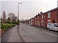
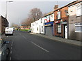
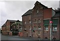
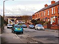

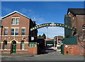
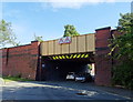
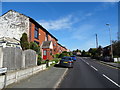
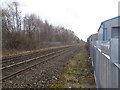
48 photos from this area
Area Information
Key information about the M24 2SF including its size, population, and administrative classification.
- Area Type
- Postcode
- Area Size
- 5318 m²
- Population
- 1469
- Population Density
- 4926 people/km²
House Prices in M24 2SF
30
Properties
£96,271
Average Sold Price
£27,000
Lowest Price
£225,000
Highest Price
Showing 30 properties
| Address | Type | Beds | Baths | Last Sale Price | Last Sale Date | |
|---|---|---|---|---|---|---|
| 17 Church Road, Middleton, M24 2SF | Terraced | 2 | 1 | £155,000 | Mar 2025 | |
| 6 Church Road, Middleton, M24 2SF | house | - | - | £190,250 | Mar 2025 | |
| 21 Church Road, Middleton, M24 2SF | Terraced | 2 | 1 | £121,000 | Jun 2022 | |
| 3 Church Road, Middleton, M24 2SF | house | - | - | £225,000 | Nov 2018 | |
| 9 Church Road, Middleton, M24 2SF | house | - | - | £65,000 | Sep 2018 | |
| 13 Church Road, Middleton, M24 2SF | house | - | - | £87,000 | Feb 2016 | |
| 8 Church Road, Middleton, M24 2SF | house | - | - | £82,500 | Sep 2014 | |
| 15 Church Road, Middleton, M24 2SF | Terraced | - | - | £53,000 | Sep 2005 | |
| 5 Church Road, Middleton, M24 2SF | Terraced | - | - | £82,000 | May 2005 | |
| 7 Church Road, Middleton, M24 2SF | Terraced | - | - | £32,500 | Jul 2001 |
Page 1 of 3
Energy Efficiency in M24 2SF
Amenities
Schools
| Rank | School | Type | Entry gender | Ages |
|---|
Explore more schools in this area
Go to Schools tabDemographics
Household Size
One person
most common
Accommodation Type
Houses
most common
Tenure
58
majority
Ethnic Group
White
most common
Religion
N/A
most common
Household Composition
N/A
most common
Age
47
median
Adults (30-64 years)
most common
Household Deprivation
N/A
with no deprivation
NS-SEC
22
in Lower managerial occupations
Explore more demographic insights in this area
Go to Demographics tabPlanning
Planning Constraints
- Flood RiskPremium
- Ramsar Wetland SitesPremium
- Area of Outstanding Natural BeautyPremium
- Protected Nature ReservePremium
- Protected WoodlandPremium