Area Overview for M24 2EB
Photos of M24 2EB

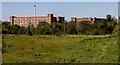
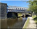
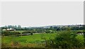
69 photos from this area
Area Information
Key information about the M24 2EB including its size, population, and administrative classification.
- Area Type
- Postcode
- Area Size
- 9457 m²
- Population
- 1345
- Population Density
- 2833 people/km²
House Prices in M24 2EB
38
Properties
£79,591
Average Sold Price
£16,000
Lowest Price
£170,000
Highest Price
Showing 38 properties
| Address | Type | Beds | Baths | Last Sale Price | Last Sale Date | |
|---|---|---|---|---|---|---|
| 558 Oldham Road, Middleton, M24 2EB | Terraced | 2 | 1 | £170,000 | Mar 2025 | |
| 552 Oldham Road, Middleton, M24 2EB | Terraced | 2 | 1 | £152,000 | Jan 2023 | |
| 502 Oldham Road, Middleton, M24 2EB | house | - | - | £120,000 | Jan 2023 | |
| 546 Oldham Road, Middleton, M24 2EB | Terraced | 2 | 1 | £121,500 | Dec 2022 | |
| 474 Oldham Road, Middleton, M24 2EB | Terraced | 2 | 1 | £90,000 | Jul 2020 | |
| 542 Oldham Road, Middleton, M24 2EB | Terraced | 3 | - | £140,000 | Jul 2020 | |
| 478 Oldham Road, Middleton, M24 2EB | Terraced | 2 | 2 | £95,000 | Apr 2019 | |
| 496 Oldham Road, Middleton, M24 2EB | house | - | - | £60,000 | Sep 2015 | |
| 472 Oldham Road, Middleton, M24 2EB | Terraced | 3 | 2 | £87,500 | Aug 2015 | |
| 532 Oldham Road, Middleton, M24 2EB | house | - | - | £60,000 | Aug 2014 |
Page 1 of 4
Energy Efficiency in M24 2EB
Amenities
Schools
| Rank | School | Type | Entry gender | Ages |
|---|
Explore more schools in this area
Go to Schools tabDemographics
Household Size
Two person
most common
Accommodation Type
Houses
most common
Tenure
71
majority
Ethnic Group
White
most common
Religion
N/A
most common
Household Composition
N/A
most common
Age
47
median
Adults (30-64 years)
most common
Household Deprivation
N/A
with no deprivation
NS-SEC
29
in Lower managerial occupations
Explore more demographic insights in this area
Go to Demographics tabPlanning
Planning Constraints
- Flood RiskPremium
- Ramsar Wetland SitesPremium
- Area of Outstanding Natural BeautyPremium
- Protected Nature ReservePremium
- Protected WoodlandPremium