Area Overview for M24 2BX
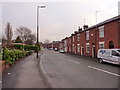
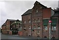
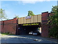
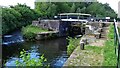
Photos of M24 2BX


Area Information
M24 2BX is a small residential cluster in England, home to 1,469 residents. Its compact size means it offers a tight-knit community feel, with homes predominantly in the form of houses rather than flats. The area’s demographics suggest a mature population, with a median age of 47 and most residents falling within the 30-64 age range. This hints at a stable, possibly family-oriented environment. Proximity to multiple railway stations, including Mills Hill and Moston, ensures easy access to nearby towns and cities. Retail options like Morrisons and Tesco are within reach, supporting daily needs. Digital connectivity is strong, with broadband and mobile scores rated excellent, making it suitable for remote work or streaming. However, the area’s small footprint means it’s best suited for those prioritising convenience over expansive space. While the flood risk is negligible, residents should note the area’s high crime risk, which requires careful consideration. Overall, M24 2BX blends practicality with accessibility, though its size limits the range of local amenities.
- Area Type
- Postcode
- Area Size
- Not available
- Population
- 1469
- Population Density
- Not available
M24 2BX is primarily an owner-occupied area, with 58% of properties owned by their residents. The accommodation type is predominantly houses, which is unusual for a small postcode area but suggests larger, more traditional homes. This contrasts with areas dominated by flats or apartments, where rental markets are more common. The limited size of the area means the housing stock is finite, which could make the property market competitive for buyers. Those seeking to purchase may find fewer options compared to larger towns, but the presence of multiple railway stations nearby could offset this by improving access to broader housing markets. The focus on owner-occupied homes also implies a community with long-term residents, which may influence the character of the area. However, the absence of specific data on property prices or trends means buyers should conduct further research on individual listings.
House Prices in M24 2BX
No properties found in this postcode.
Energy Efficiency in M24 2BX
Daily life in M24 2BX is shaped by its proximity to retail and transport hubs. Supermarkets such as Morrisons, Tesco Middleton, and Tesco Alkrington provide easy access to groceries, while the multiple railway stations—Mills Hill, Moston, and Castleton—offer connections to nearby towns. The metro stops at Freehold and South Chadderton add to the area’s mobility, though the single bus stop at Chorlton Street Coach Station is less extensive. The compact size of the area means amenities are concentrated, requiring minimal travel for essentials. However, the absence of specific data on parks, leisure facilities, or dining options means the character of the local lifestyle remains partially undefined. Residents may need to look beyond the immediate postcode for cultural or recreational activities. The combination of retail and transport options, however, ensures that daily errands and commuting are manageable within a short radius.
Amenities
Schools
| Rank | School | Type | Entry gender | Ages |
|---|
Explore more schools in this area
Go to Schools tabDemographics
The population of M24 2BX skews towards adults aged 30-64, with a median age of 47. This suggests a community of middle-aged individuals, likely settled in long-term homes. Home ownership is strong, with 58% of properties owned outright, indicating a degree of stability. The predominant accommodation type is houses, which aligns with the area’s small, residential character. Ethnically, the population is predominantly White, though no further breakdown is provided. The absence of specific data on deprivation or diversity means these factors remain unquantified. For buyers, the high home ownership rate may reflect a lack of rental properties, potentially limiting options for those seeking to rent. The age profile also implies a community with established roots, though the lack of younger residents could affect local schools and amenities.
Household Size
Accommodation Type
Tenure
Ethnic Group
Religion
Household Composition
Age
Household Deprivation
NS-SEC
Explore more demographic insights in this area
Go to Demographics tabPlanning
Planning Constraints
- Flood RiskPremium
- Ramsar Wetland SitesPremium
- Area of Outstanding Natural BeautyPremium
- Protected Nature ReservePremium
- Protected WoodlandPremium