Area Overview for M24 1FD
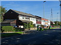
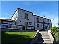
Photos of M24 1FD


Area Information
M24 1FD is a small, tightly knit residential postcode area in England, home to 1,735 people spread across a compact cluster of properties. With a population density of 673 people per square kilometre, the area feels lived-in and community-focused. It is primarily a housing area, with 85% of residents owning their homes, suggesting a stable, long-term demographic. The median age of 47 indicates a mature population, with the majority of residents falling between 30 and 64 years old. This makes it a place where families and established professionals coexist, often in single-family homes. Daily life here is shaped by proximity to local amenities, including retail stores, rail networks, and schools. While the area is small, its accessibility to transport links and essential services means it balances suburban comfort with urban connectivity. For those seeking a quiet, well-established neighbourhood with a focus on home ownership, M24 1FD offers a snapshot of traditional English residential living, though buyers should consider the broader context of its size and surrounding infrastructure.
- Area Type
- Postcode
- Area Size
- Not available
- Population
- 1735
- Population Density
- 673 people/km²
The property market in M24 1FD is characterised by high home ownership (85%) and a predominance of houses over flats or apartments. This suggests a community where residential properties are largely owner-occupied, with limited rental activity. The focus on single-family homes implies that the area caters to households requiring more space, often for families or professionals seeking traditional housing. Given the small size of the postcode, the immediate surroundings may offer similar housing stock, though buyers should consider the broader regional market for comparable options. The high home ownership rate also indicates a stable market with lower turnover, which can be advantageous for long-term investors. However, the limited data on property types or price ranges means buyers must conduct further local research. For those prioritising a residential, family-friendly environment with established homes, M24 1FD aligns with these criteria, but its compact nature may require looking beyond the immediate postcode for additional choices.
House Prices in M24 1FD
No properties found in this postcode.
Energy Efficiency in M24 1FD
The lifestyle in M24 1FD is shaped by its proximity to a variety of retail and transport hubs. Within walking distance are five retail outlets, including Aldi Unit 1, Morrisons Daily, and Tesco Alkrington, offering everyday shopping needs. The area’s rail and metro stations provide easy access to nearby towns and cities, while the single bus stop at Chorlton Street Coach Station connects to local routes. Though the number of leisure or recreational facilities is not specified, the density of retail and transport options suggests a practical, service-oriented lifestyle. The presence of multiple schools and transport links indicates that daily life is focused on convenience and accessibility. For those who prioritise proximity to shops, public transport, and educational institutions, M24 1FD delivers a functional environment. However, the lack of specific data on parks or leisure venues means the area’s recreational offerings remain unclear, requiring further local investigation.
Amenities
Schools
Residents of M24 1FD have access to a range of educational institutions, including primary and special schools. The Radclyffe School, a primary school with a good Ofsted rating, provides a solid foundation for younger children. Nearby is Ferney Field Community Special School, which caters to students with specific educational needs. Additionally, the Blessed John Henry Newman Roman Catholic College, another primary school, has a satisfactory Ofsted rating. The mix of school types ensures that families with diverse needs can find appropriate provisions within the area. While the presence of a special school highlights the community’s commitment to inclusive education, the absence of secondary schools means students may need to travel to nearby postcodes for higher education. For families prioritising proximity to schools, the combination of primary options and specialist provision offers a practical, if limited, selection.
| Rank | School | Type | Entry gender | Ages |
|---|
Explore more schools in this area
Go to Schools tabDemographics
The population of M24 1FD is predominantly composed of adults aged 30 to 64, reflecting a mature, settled community. With a median age of 47, the area is less likely to attract younger families or students, though this is not absolute. Home ownership is high at 85%, indicating a strong presence of long-term residents and a lower proportion of renters. The accommodation type is primarily houses, which aligns with the demographic profile of older, family-oriented households. The predominant ethnic group is White, though no specific data on diversity or deprivation is provided. The high home ownership rate and age profile suggest a community with lower turnover and a focus on stability. However, the lack of specific data on income levels or deprivation means the quality of life implications of these demographics remain partially unexplored. For buyers, this profile indicates a neighbourhood where property is likely to retain value but may appeal more to those seeking established living rather than growth-oriented investment.
Household Size
Accommodation Type
Tenure
Ethnic Group
Religion
Household Composition
Age
Household Deprivation
NS-SEC
Explore more demographic insights in this area
Go to Demographics tabPlanning
Planning Constraints
- Flood RiskPremium
- Ramsar Wetland SitesPremium
- Area of Outstanding Natural BeautyPremium
- Protected Nature ReservePremium
- Protected WoodlandPremium