Area Overview for M24 1AX
Photos of M24 1AX
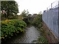


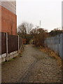
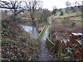


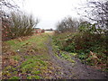

56 photos from this area
Area Information
Key information about the M24 1AX including its size, population, and administrative classification.
- Area Type
- Postcode
- Area Size
- 3928 m²
- Population
- 1623
- Population Density
- 4299 people/km²
House Prices in M24 1AX
18
Properties
£50,893
Average Sold Price
£12,000
Lowest Price
£134,500
Highest Price
Showing 18 properties
| Address | Type | Beds | Baths | Last Sale Price | Last Sale Date | |
|---|---|---|---|---|---|---|
| 92 Oldham Road, Middleton, M24 1AX | house | - | - | £134,500 | Jul 2021 | |
| 104 Oldham Road, Middleton, M24 1AX | Flat | - | - | £39,500 | Jun 2021 | |
| 106 Oldham Road, Middleton, M24 1AX | Flat | - | - | £39,500 | Jun 2021 | |
| 110 Oldham Road, Middleton, M24 1AX | Flat | - | - | £39,500 | May 2021 | |
| 88 Oldham Road, Middleton, M24 1AX | house | - | - | £90,000 | Sep 2019 | |
| 108 Oldham Road, Middleton, M24 1AX | Flat | - | - | £40,000 | Oct 2017 | |
| 98 Oldham Road, Middleton, M24 1AX | house | - | - | £65,000 | Nov 2015 | |
| 90 Oldham Road, Middleton, M24 1AX | Semi-detached | 2 | - | £67,000 | May 2013 | |
| 100 Oldham Road, Middleton, M24 1AX | house | 2 | 1 | £64,000 | Nov 2009 | |
| 114 Oldham Road, Middleton, M24 1AX | Flat | - | - | £32,000 | Nov 2004 |
Page 1 of 2
Energy Efficiency in M24 1AX
Amenities
Schools
| Rank | School | Type | Entry gender | Ages |
|---|
Explore more schools in this area
Go to Schools tabDemographics
Household Size
One person
most common
Accommodation Type
Houses
most common
Tenure
61
majority
Ethnic Group
White
most common
Religion
N/A
most common
Household Composition
N/A
most common
Age
47
median
Adults (30-64 years)
most common
Household Deprivation
N/A
with no deprivation
NS-SEC
30
in Lower managerial occupations
Explore more demographic insights in this area
Go to Demographics tabPlanning
Planning Constraints
- Flood RiskPremium
- Ramsar Wetland SitesPremium
- Area of Outstanding Natural BeautyPremium
- Protected Nature ReservePremium
- Protected WoodlandPremium