Area Overview for M23 9JT
Photos of M23 9JT
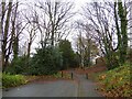
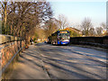
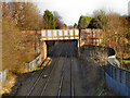
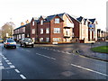
15 photos from this area
Area Information
Key information about the M23 9JT including its size, population, and administrative classification.
- Area Type
- Postcode
- Area Size
- 1.8 hectares
- Population
- 1745
- Population Density
- 3277 people/km²
House Prices in M23 9JT
26
Properties
£320,994
Average Sold Price
£52,000
Lowest Price
£700,000
Highest Price
Showing 26 properties
| Address | Type | Beds | Baths | Last Sale Price | Last Sale Date | |
|---|---|---|---|---|---|---|
| 23 New Forest Road, Manchester, M23 9JT | Detached | 4 | 2 | £663,000 | Jul 2025 | |
| 25 New Forest Road, Manchester, M23 9JT | house | 4 | 2 | £555,000 | Apr 2024 | |
| 1 New Forest Road, Manchester, M23 9JT | Detached | 5 | 2 | £700,000 | Mar 2024 | |
| 39 New Forest Road, Manchester, M23 9JT | house | - | - | £492,100 | Dec 2021 | |
| 43 New Forest Road, Manchester, M23 9JT | Detached | 3 | 1 | £210,000 | Aug 2021 | |
| 27 New Forest Road, Manchester, M23 9JT | Detached | 4 | - | £411,050 | Jul 2019 | |
| 41 New Forest Road, Manchester, M23 9JT | Detached | 3 | - | £384,000 | Jul 2018 | |
| 37 New Forest Road, Manchester, M23 9JT | house | 3 | - | £310,000 | Feb 2017 | |
| 29 New Forest Road, Manchester, M23 9JT | house | - | - | £330,000 | Jul 2016 | |
| 47 New Forest Road, Manchester, M23 9JT | Detached | 3 | - | £325,000 | Aug 2015 |
Page 1 of 3
Energy Efficiency in M23 9JT
Amenities
Schools
| Rank | School | Type | Entry gender | Ages |
|---|
Explore more schools in this area
Go to Schools tabDemographics
Household Size
One person
most common
Accommodation Type
Houses
most common
Tenure
78
majority
Ethnic Group
White
most common
Religion
N/A
most common
Household Composition
N/A
most common
Age
47
median
Adults (30-64 years)
most common
Household Deprivation
N/A
with no deprivation
NS-SEC
43
in Lower managerial occupations
Explore more demographic insights in this area
Go to Demographics tabPlanning
Planning Constraints
- Flood RiskPremium
- Ramsar Wetland SitesPremium
- Area of Outstanding Natural BeautyPremium
- Protected Nature ReservePremium
- Protected WoodlandPremium