Area Overview for M23 9HY
Photos of M23 9HY


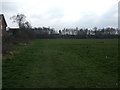
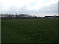

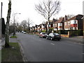


10 photos from this area
Area Information
Key information about the M23 9HY including its size, population, and administrative classification.
- Area Type
- Postcode
- Area Size
- 5770 m²
- Population
- 1745
- Population Density
- 302419 people/km²
House Prices in M23 9HY
30
Properties
£70,375
Average Sold Price
£38,500
Lowest Price
£112,500
Highest Price
Showing 30 properties
| Address | Type | Beds | Baths | Last Sale Price | Last Sale Date | |
|---|---|---|---|---|---|---|
| 22, Guardian Mews, Cotteril Close, Manchester, M23 9HY | Flat | - | - | £112,500 | Feb 2024 | |
| 10, Guardian Mews, Cotteril Close, Manchester, M23 9HY | Flat | - | - | £87,000 | Jul 2022 | |
| 23, Guardian Mews, Cotteril Close, Manchester, M23 9HY | Flat | - | - | £95,000 | Apr 2022 | |
| 2, Guardian Mews, Cotteril Close, Manchester, M23 9HY | Flat | - | - | £90,000 | Jul 2021 | |
| 19, Guardian Mews, Cotteril Close, Manchester, M23 9HY | Flat | 2 | - | £84,000 | Feb 2021 | |
| 15, Guardian Mews, Cotteril Close, Manchester, M23 9HY | Flat | - | - | £88,000 | Sep 2019 | |
| 17, Guardian Mews, Cotteril Close, Manchester, M23 9HY | Flat | - | - | £81,000 | Jul 2019 | |
| 24, Guardian Mews, Cotteril Close, Manchester, M23 9HY | Flat | - | - | £79,950 | Jun 2019 | |
| 3, Guardian Mews, Cotteril Close, Manchester, M23 9HY | Flat | - | - | £76,000 | Mar 2019 | |
| 21, Guardian Mews, Cotteril Close, Manchester, M23 9HY | Flat | - | - | £82,000 | Nov 2018 |
Page 1 of 3
Energy Efficiency in M23 9HY
Amenities
Schools
| Rank | School | Type | Entry gender | Ages |
|---|
Explore more schools in this area
Go to Schools tabDemographics
Household Size
One person
most common
Accommodation Type
Houses
most common
Tenure
78
majority
Ethnic Group
White
most common
Religion
N/A
most common
Household Composition
N/A
most common
Age
47
median
Adults (30-64 years)
most common
Household Deprivation
N/A
with no deprivation
NS-SEC
43
in Lower managerial occupations
Explore more demographic insights in this area
Go to Demographics tabPlanning
Planning Constraints
- Flood RiskPremium
- Ramsar Wetland SitesPremium
- Area of Outstanding Natural BeautyPremium
- Protected Nature ReservePremium
- Protected WoodlandPremium