Area Overview for M23 9HX
Photos of M23 9HX
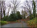
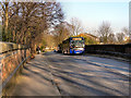
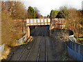
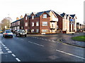
15 photos from this area
Area Information
Key information about the M23 9HX including its size, population, and administrative classification.
- Area Type
- Postcode
- Area Size
- 9311 m²
- Population
- 1460
- Population Density
- 5626 people/km²
House Prices in M23 9HX
23
Properties
£133,264
Average Sold Price
£45,500
Lowest Price
£223,000
Highest Price
Showing 23 properties
| Address | Type | Beds | Baths | Last Sale Price | Last Sale Date | |
|---|---|---|---|---|---|---|
| 17 Carrswood Road, Manchester, M23 9HX | Terraced | - | - | £223,000 | Oct 2023 | |
| 39 Carrswood Road, Manchester, M23 9HX | house | - | - | £222,500 | Oct 2020 | |
| 29 Carrswood Road, Manchester, M23 9HX | house | - | - | £145,000 | Mar 2017 | |
| 19 Carrswood Road, Manchester, M23 9HX | house | 3 | - | £140,000 | Aug 2016 | |
| 15 Carrswood Road, Manchester, M23 9HX | house | - | - | £139,950 | Jul 2015 | |
| 1 Carrswood Road, Manchester, M23 9HX | Flat | 3 | - | £97,500 | Jul 2014 | |
| 23 Carrswood Road, Manchester, M23 9HX | house | 3 | - | £109,500 | Sep 2012 | |
| 21 Carrswood Road, Manchester, M23 9HX | Terraced | 3 | 2 | £118,000 | Oct 2007 | |
| 25 Carrswood Road, Manchester, M23 9HX | Terraced | - | - | £105,000 | Jul 2007 | |
| 3 Carrswood Road, Manchester, M23 9HX | Terraced | 3 | 1 | £119,950 | Aug 2005 |
Page 1 of 3
Energy Efficiency in M23 9HX
Amenities
Schools
| Rank | School | Type | Entry gender | Ages |
|---|
Explore more schools in this area
Go to Schools tabDemographics
Household Size
Family (3-5 people)
most common
Accommodation Type
Houses
most common
Tenure
53
majority
Ethnic Group
White
most common
Religion
N/A
most common
Household Composition
N/A
most common
Age
47
median
Adults (30-64 years)
most common
Household Deprivation
N/A
with no deprivation
NS-SEC
26
in Lower managerial occupations
Explore more demographic insights in this area
Go to Demographics tabPlanning
Planning Constraints
- Flood RiskPremium
- Ramsar Wetland SitesPremium
- Area of Outstanding Natural BeautyPremium
- Protected Nature ReservePremium
- Protected WoodlandPremium